By
By Read Luoyang Henan Through Its Ancient City Gates
How can a first-time visitor tell whether a gate ruin represents a city entrance, a palace threshold, a ceremonial route, or a later reconstruction? The answer is to stop treating each site as an isolated attraction. In luoyang henan, gates provide practical evidence for reading how different capitals were planned, defended, entered, and reshaped over time.
A gate is more than a wall opening. City gates can reveal the direction of major roads, the relationship between outer walls and palace zones, and the degree of control placed on movement through the urban landscape. For independent learners, this creates a useful visit strategy: compare what survives on the ground with what is reconstructed in museums, then ask what each form of evidence can and cannot prove.
The challenge in luoyang henan is that remains from more than one historical urban layout may be encountered during the same trip. A visitor who expects one continuous ancient city will become confused. A visitor who separates periods, city functions, and evidence types can build a much clearer picture.

Start by separating the city layers before choosing sites
The most useful first decision is to treat the ancient capitals around luoyang henan as different urban systems rather than as one large archaeological zone. This approach fits visitors who have limited time and want to understand why a gate in one area may not align with roads, walls, or monuments seen elsewhere. It does not apply if your goal is only scenic photography, because the method requires note-taking and comparison.
Use three questions before adding a gate or ruin to your itinerary:
- Which city layer am I looking at? Identify whether the site is interpreted as part of an earlier capital, a later capital, a palace district, or a broader settlement area.
- What kind of boundary did the gate control? A gate may belong to an outer city wall, an inner enclosure, a palace precinct, or a ceremonial route. Do not assume every large gateway served the same role.
- What is physically original and what is interpretive? Foundations, excavated wall traces, protective shelters, digital displays, scale models, and rebuilt elevations communicate different levels of certainty.
This distinction matters in luoyang henan because archaeological landscapes are often interpreted through fragments. A foundation may show location and footprint more reliably than height. A museum model may make spatial relationships easier to understand, but it may combine excavated evidence with scholarly interpretation. Both are useful when viewed together.
| Evidence type | What it helps you read | Best visitor question | Its limit |
|---|---|---|---|
| Gate foundations | Position, width relationship, orientation, and approach route | Which direction did traffic pass through this boundary? | Foundation remains rarely explain the full appearance of the original structure. |
| Wall traces and earthworks | Scale of enclosure and separation between districts | What did this wall include or exclude? | Later disturbance can make routes difficult to follow visually. |
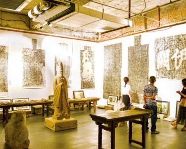
| Museum reconstruction | Possible massing, circulation, and relationship between buildings | Which parts are excavated evidence and which parts are reconstructed? | A model should not be treated as a surviving city view. |
| Modern map | Distance, access, and site-to-site comparison | Can I visit linked sites in one logical sequence? | Modern streets may not follow ancient routes. |
Use gates, ruins, and museum reconstructions as an urban reading method
This action-based method is the central way to interpret luoyang henan before and during a visit. It works best for travelers who want to understand changing urban layout rather than simply identify landmarks. The method has a clear limit: it cannot resolve every scholarly debate, and it should not turn a reconstructed display into unquestioned fact.
-
Choose one gate as your anchor point.
Select a documented gate site, such as Dingding Gate or Yingtian Gate, and write down its stated relationship to the surrounding city or palace area. The purpose is not to memorize names. The purpose is to establish one fixed point from which roads, walls, and districts can be compared.
-
Identify the boundary behind the gate.
Ask whether the gate marks an outer urban edge, an internal wall, or a palace-related enclosure. This is the key checkpoint. If you cannot identify the boundary, do not yet draw conclusions about the gate’s importance.
-
Trace the direction of movement.
Look for the road axis, open approach space, wall alignment, or museum diagram associated with the entrance. A gate facing a major route may suggest planned movement into an important district. This interpretation fits when site information shows a spatial connection; it does not apply when the route is uncertain or heavily altered.
-
Compare the ruin with a reconstruction.
At the site or in a museum, compare the excavated footprint with a physical model, illustration, or digital display. Mark what remains visible on the ground and what has been added to explain volume, roofing, towers, or ceremonial use.
-
Place the gate within a larger map.
Check whether the gate aligns with another wall, palace zone, market area, watercourse, or ceremonial avenue shown in interpretation materials. In luoyang henan, this step prevents the common mistake of reading a gate as a standalone monument.
-
Repeat with a second site from another urban layer.
Your comparison becomes meaningful only when you test a second gate or ruin against the first. Look for changes in enclosure scale, access pattern, ceremonial emphasis, and the relationship between political space and everyday movement.
The conclusion from this method is straightforward: gates are strongest as comparative tools. One gate can show an entrance. Two or more gates, read alongside walls and reconstructions, can show how urban priorities changed. This is especially useful in luoyang henan, where a visitor may move between sites that belong to different historical city plans.

Key checkpoints at every gate site
- Orientation: Determine which direction the entrance faces before reading the display text. Direction often matters more than decorative details.
- Threshold sequence: Look for evidence of passage through walls, courtyards, towers, bridges, or controlled approach spaces.
- Scale comparison: Compare the gate footprint with nearby roads and enclosure lines. A large gate may indicate an important route, but size alone does not prove ceremonial rank.
- Interpretation label: Separate statements based on excavation from phrases such as “reconstructed,” “restored,” “modeled,” or “based on research.”
- Period marker: Confirm the historical layer before comparing it with another location in luoyang henan.
Build a practical gate-focused visit route before arrival
A good route should move from orientation to evidence, not from famous site to famous site. For a first visit to luoyang henan, begin with a museum or interpretive center where you can see maps and reconstructions, then visit a gate or wall-remain site, and finally review your notes against a second location. This sequence fits independent learners. It may not fit travelers with mobility constraints, short opening windows, or fixed group-tour schedules.
| Visit stage | Action to take | What to record | Failure to avoid |
|---|---|---|---|
| Before departure | Mark two gate-related sites and one museum on a map. | Site name, stated period, and access location. | Planning sites from different periods as if they form one walkable ancient route. |
| First museum stop | Photograph or sketch the city plan displayed there. | Wall lines, gate positions, major roads, and palace areas. | Photographing labels without recording what the image is meant to explain. |
| Gate or ruin visit | Stand back and identify the approach direction before studying details. | Visible foundations, modern protective structures, and nearby topography. | Assuming the modern entrance follows the ancient route. |
| Second site comparison | Compare boundary type and road relationship. | Similarities and differences in access control. | Calling one gate “more important” without evidence from the site interpretation. |
| Evening review | Redraw the route from memory using your notes. | What changed between city layers. | Relying only on photographs, which often remove spatial context. |
When planning transport, use the museum map as an interpretive tool rather than a navigation guarantee. Modern roads, entry points, ticketing areas, and protective buildings can alter how you reach the remains. In luoyang henan, the ancient route you are studying may be visible only as an alignment on a display, not as a path you can physically follow.
Recognize common interpretation mistakes before they confuse your visit
The strongest independent visits are built on careful limits. The following mistakes are common when reading ancient urban remains in luoyang henan, especially when a reconstructed gate looks more visually complete than a low archaeological foundation.
- Mistake: treating a reconstruction as a replica.
Use reconstruction displays to understand possible form and circulation. Do not assume every visible roofline, color, tower, or surface treatment has survived as direct evidence. - Mistake: treating every gate as a main city entrance.
Check whether the gate belongs to an outer wall, internal enclosure, palace sector, or ceremonial complex. The conclusion should match the boundary type. - Mistake: comparing sites without confirming their periods.
Write the period shown on each site label before making comparisons. This matters because different city layouts can overlap geographically without being contemporary. - Mistake: using distance as proof of urban importance.
Long distances can indicate scale, but they do not automatically show political status, population, or ceremonial hierarchy. Use site interpretation and spatial relationships together. - Mistake: ignoring what is missing.
Absence of visible walls or roads does not prove they never existed. Excavation limits, preservation conditions, and modern development can affect what you see.
A sensible conclusion for luoyang henan is that gates should be read as evidence within a system. Their value comes from position, orientation, boundary relationship, and comparison with other remains. A single impressive structure can attract attention; a mapped sequence of sites explains the city.
Use this decision checklist to turn observations into a city map
Before leaving each location, use the checklist below. It is designed for visitors who want a defensible interpretation rather than a collection of disconnected facts. If you cannot answer a question, mark it as unresolved instead of filling the gap with an assumption.
- Can I name the city layer or historical context presented for this site?
- Do I know whether this gate belonged to an outer wall, inner enclosure, or palace-related boundary?
- Have I identified the likely direction of movement through the entrance?
- Have I distinguished excavated remains from reconstructed elements?
- Can I locate this gate relative to at least one road, wall line, or major district?
- Have I compared it with a second site in luoyang henan?
- Can I state one observation that is certain and one interpretation that remains tentative?
If you can answer most of these questions, you are no longer viewing isolated ruins. You are building a working map of how luoyang henan changed through successive urban plans, controlled movement through gates, and organized political and ceremonial space.
Request a pre-visit route review if you want help turning your chosen gate sites into a practical learning itinerary.