 By
By Connecting Luoyang, Henan, China’s Past to Present
How does one truly grasp the layered history of a city like Luoyang, Henan, China, where centuries of dynastic rule and urban development have shaped its present form? The challenge for many lies in bridging the gap between ancient texts and the contemporary urban landscape. Understanding this evolution requires a framework that connects surviving capital-era sites, the influence of river geography, and the layout of present-day districts into a coherent, chronological narrative. This article provides a clear methodology for tracing Luoyang’s shift from a powerful ancient capital to its modern identity.
Understanding Luoyang’s Historical Geography and Dynastic Footprints
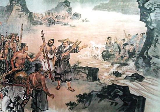
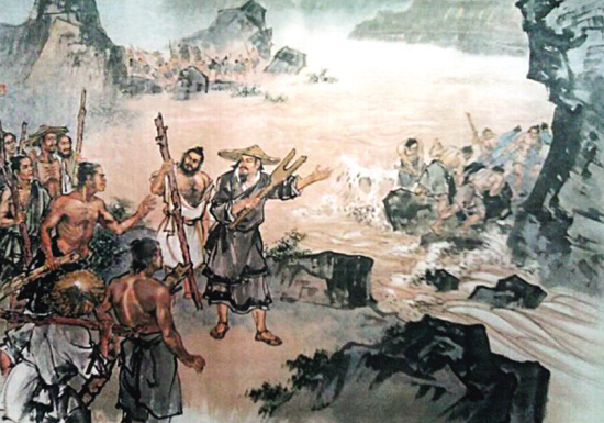
Luoyang, Henan, China, has served as a capital for numerous dynasties, earning it a unique place in Chinese history. Its strategic location, nestled in the fertile plains of the Yellow River basin, provided both agricultural abundance and defensive advantages. The city’s growth and decline were often intrinsically linked to the river’s course and the prevailing political climate. Early capitals were frequently established close to water sources for transportation and sustenance, a pattern evident in Luoyang’s various historical iterations.
The city’s historical geography is not static; rather, it shifted over time. Different dynasties built new capital cities, sometimes on the ruins of their predecessors, sometimes in entirely new locations within the broader Luoyang area. This means that “Luoyang” as a capital city refers not to a single fixed point but to a succession of urban centers, each leaving its own archaeological and cultural mark. To truly appreciate this, one must recognize that modern Luoyang occupies a footprint that encapsulates, but does not always directly overlay, these past manifestations.
- Geographic Foundation: The Yi and Luo Rivers, tributaries of the Yellow River, were crucial for early settlement and defense. Their confluence and courses influenced city planning.
- Dynastic Shifts: Each major dynastic period (e.g., Eastern Zhou, Eastern Han, Northern Wei, Sui, Tang) saw a distinct capital city built, often with unique architectural styles and urban layouts.
- Archaeological Evidence: Modern excavations continually reveal the precise locations and structures of these ancient cities, offering concrete data points for historical mapping.
Connecting Ancient Sites, River Geography, and Modern Districts: A Chronological Approach
Deciphering the chronological city narrative of Luoyang requires a methodical approach that integrates historical data with geographical understanding. This section outlines how to connect the dots between the remnants of capital-era sites, the enduring influence of river systems, and the structure of present-day districts.
The process involves several key steps, each with specific checkpoints and common pitfalls to avoid:
- Identify Key Dynastic Capitals and Their Locations:
- Step: Research the major dynasties that established capitals in the Luoyang region. For each, pinpoint its approximate geographical coordinates and historical name (e.g., Western Zhou’s Chengzhou, Eastern Han’s Luoyang City, Sui-Tang Luoyang).
- Checkpoint: Can you name at least three distinct capital city sites within the greater Luoyang area and their associated dynasties?
- Common Failure: Assuming “Luoyang” always refers to the same physical city or confusing different dynastic capitals built in proximity.
- Map Historical River Courses and Their Impact:
- Step: Study historical maps illustrating the courses of the Yellow, Luo, and Yi Rivers during different eras. Understand how these waterways dictated city placement, defense, and trade routes.
- Checkpoint: Can you describe how the Luo River influenced the layout or defense of at least one ancient Luoyang capital?
- Common Failure: Overlooking the dynamic nature of rivers; assuming modern river courses perfectly match ancient ones.
- Overlay Ancient Sites onto Modern Maps:
- Step: Use archaeological site plans or historical geographical information systems (GIS) data to place the known boundaries and key structures of ancient capitals onto a contemporary map of Luoyang. Identify which modern districts or landmarks now occupy these historical footprints.
- Checkpoint: Can you point to a modern district (e.g., Laocheng District) and identify which ancient capital’s ruins lie beneath or within its boundaries?
- Common Failure: Disconnecting ancient sites from their present-day context, making it hard to visualize the continuity or discontinuity.
- Trace Urban Development Trajectories:
- Step: Analyze how the decline of one capital and the rise of another influenced population shifts and infrastructure development. Observe patterns of urban expansion and contraction.
- Checkpoint: Can you explain how the abandonment of one capital site might have contributed to the growth of another nearby, or how resources were repurposed?
- Common Failure: Viewing each capital as an isolated entity rather than part of a continuous, if sometimes shifting, urban landscape.
This systematic approach reveals the intricate relationship between Luoyang’s past and present, making its vast history more tangible. By understanding where the ancient capitals stood in relation to the rivers and today’s districts, one can build a robust chronological city narrative.
The Evolution of Urban Planning: From Dynastic Grandeur to Modern Functionality
The urban planning of Luoyang, Henan, China, reflects a fascinating evolution, from the meticulously designed grid layouts of imperial capitals to the more organically grown and functionally diverse districts of the modern era. Early dynastic cities, such as the Sui-Tang Luoyang, were often built on a grand scale, adhering to strict cosmological and political principles. These cities featured symmetrical layouts, imperial palaces at their northern center, and a clear division of residential, commercial, and administrative zones. The use of canals and waterways for transport and sanitation was also a hallmark of this sophisticated planning.
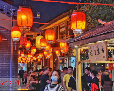
Modern urban development in Luoyang has, by necessity, adapted to contemporary needs, including industrialization, increased population density, and efficient transportation networks. While some historical districts, like Laocheng District, retain a sense of ancient charm with narrow streets and traditional architecture, much of the city has undergone significant modernization. This has involved the construction of wide avenues, high-rise buildings, and extensive public infrastructure. The challenge for modern planners is to balance heritage preservation with the demands of a growing metropolis.
Here’s a comparison of urban planning principles:
| Characteristic | Ancient Capital (e.g., Sui-Tang Luoyang) | Modern Luoyang City |
|---|---|---|
| Primary Goal | Symbolic power, imperial residence, administrative control, cosmic harmony. | Economic development, population growth, efficient infrastructure, quality of life. |
| Layout | Strict grid pattern, symmetrical, cardinal directions, imperial palace central. | Hybrid grid and organic growth, adapting to topography and existing structures. |
| Key Infrastructure | Canals, city walls, imperial roads, grand gates, market districts. | Expressways, railway lines, subway systems, modern utilities, industrial parks. |
| Residential Zones | Walled wards, distinct social stratification, courtyard houses. | High-rise apartments, planned communities, diverse housing options. |
| Water Management | Canals for transport and sanitation, reliance on natural rivers. | Modern water treatment, flood control systems, riverfront development. |
| Preservation Focus | Constructing new, grand structures. | Protecting historical sites and cultural heritage, integrating old with new. |
This table highlights how the functional and aesthetic priorities of urban development have transformed over centuries in Luoyang, Henan, China. The modern city prioritizes connectivity and economic efficiency, while still striving to respect its profound historical roots.
Navigating Cultural Heritage Sites in Modern Luoyang
For those seeking to connect with Luoyang’s past, visiting its numerous cultural heritage sites is essential. However, understanding their context within the modern city is key to a meaningful experience. Many prominent historical sites are now protected areas, often surrounded by contemporary urban sprawl. Knowing which sites belong to which historical period, and how they relate geographically, enhances the visitor’s journey.
It is important to remember that not all ancient capitals are equally visible today. Some exist primarily as archaeological parks, while others have temples or monuments built upon their former grounds. The Longmen Grottoes, for example, a UNESCO World Heritage site, sit along the Yi River, a constant geological feature that has witnessed centuries of human activity. The White Horse Temple, considered the first Buddhist temple in China, also stands as a testament to Luoyang’s enduring spiritual legacy. These sites are not merely isolated attractions but integral parts of the evolving story of Luoyang.
When exploring Luoyang’s cultural heritage, consider these practical tips:
- Prioritize Chronologically: Start your exploration with sites from earlier dynasties before moving to later ones to build a mental timeline.
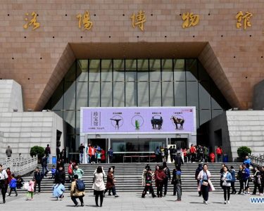
- Utilize Local Museums: The Luoyang Museum offers excellent exhibits that often include maps and artifacts illustrating the city’s historical layers, providing crucial context before field visits.
- Observe Geographical Markers: Pay attention to the Luo and Yi Rivers. Many key historical sites are located near these waterways, underscoring their historical importance.
- Look for Overlapping History: At sites like the Sui-Tang City National Heritage Park, observe how different dynastic layers are presented, showing the re-use and re-imagining of urban spaces over time.
- Engage with Local Guides: Knowledgeable local guides can provide invaluable insights into the specific historical significance and modern context of each site, enhancing your understanding of Luoyang, Henan, China.
By consciously connecting these historical fragments to the broader narrative of Luoyang, one can move beyond simply visiting landmarks to truly understanding the city as a living, evolving entity. This approach transforms a collection of sites into a coherent story of continuity and change.
To learn more about the historical significance of cities like Luoyang, explore further resources or consult with regional experts.