
Blog
How Geography Forged the Strategic Luoyang City Plan

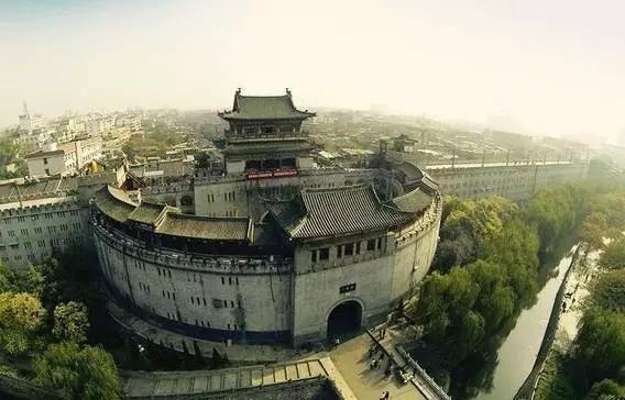
How Geography Forged the Strategic Luoyang City Plan
Why was Luoyang chosen as the capital by so many of China’s most powerful dynasties? The answer is etched into the landscape itself. The strategic advantages that made the historic Luoyang city a seat of power were not man-made; they were a direct result of its unique geography, defined by a careful balance of rivers, mountains, and fertile plains. Understanding this geographic blueprint is key to grasping why this location was central to Chinese history for millennia.
This confluence of natural features provided everything an imperial capital required: defense, sustenance, and control over critical trade routes. The city’s planners did not fight the terrain; they leveraged it, creating an urban center that was both a fortress and a thriving economic hub. For anyone studying the development of ancient Chinese capitals, the layout of Luoyang serves as a masterclass in geostrategy.
The Geographic Blueprint: Luoyang’s Strategic Position Explained
The placement of Luoyang was no accident. It sits in a corridor protected by natural barriers, making it an ideal defensive location while granting it control over essential resources. The interaction between four key geographic elements—the Luo River, the Yellow River, the surrounding mountains, and the plains—created a near-perfect basin for a capital city. Each feature played a distinct and complementary role in both defense and urban development.
Analyzing these elements reveals how the landscape directly influenced the city’s long-term viability. A failure to understand this interplay would have left the capital vulnerable to invasion, famine, or logistical collapse.
Here is a breakdown of how each geographical feature contributed to Luoyang’s strategic advantage:
- The Luo River (Southern Flank): The city was historically situated on the northern bank of the Luo River. This placement was deliberate. The river served as a wide, natural moat, protecting Luoyang’s southern approach. Any invading army from the south would face a significant obstacle, giving defenders a major tactical advantage. Beyond defense, the Luo River was the city’s primary source of water for daily life and a vital transportation channel, connecting it to other regions.
- The Yellow River (Northern Corridor): Further to the north, the mighty Yellow River created a much larger strategic boundary. While not directly adjacent to the city walls, its presence defined the entire region. The river valley acted as a major east-west transportation and communication corridor, which Luoyang controlled. However, the Yellow River was also a source of devastating floods, a constant threat that ancient engineers had to manage. Its unpredictable nature made a direct northern assault on the region difficult.
- The Mountains (Northern and Southern Barriers): Luoyang is shielded by mountains on multiple sides. To the north lie the Mangshan Mountains, which served as a formidable barrier against invasions from the northern plains. To the south and east are the Funiu and Songshan Mountains. This mountainous encirclement created a protected basin, forcing any potential attacker into predictable passes and valleys where they could be more easily intercepted.
- The Yiluo Plains (The Agricultural Heart): Nestled within this protected basin are the fertile Yiluo Plains. This expansive flatland was the city’s granary, capable of producing enough food to sustain a massive urban population, including the imperial court, bureaucrats, and a large army. Without this agricultural base, a capital of Luoyang’s size would have been impossible to maintain. The plains also provided level ground ideal for large-scale urban construction.
Water as the Lifeblood: Sustenance, Trade, and Urban Planning
While the defensive aspects of the Luoyang geography are clear, the role of the Luo and Yellow Rivers extended far beyond military strategy. They were the arteries that supplied the city with resources, connected it to the wider empire, and shaped the very layout of its internal districts. The management of water was a core component of municipal governance.
The primary water source for the city’s inhabitants was the Luo River. Ancient engineers constructed canals diverting water from the Luo into the city for consumption, sanitation, and the irrigation of imperial gardens. This reliable water supply was a prerequisite for supporting the dense population of one of the world’s largest cities at the time.
In terms of commerce, the rivers were highways. The Luo River connected to a network of canals and other waterways, allowing grain, timber, and other essential goods to be transported to the capital with an efficiency that land transport could not match. This riverine logistics network was crucial for supplying the armies guarding the frontiers and for facilitating trade that enriched the imperial treasury. The presence of the Yellow River corridor further cemented the region’s status as a commercial nexus, linking the political center with the economic powerhouses of eastern China.
Common Mistakes in Assessing River-Based City Locations
When studying ancient urban centers like Luoyang, it’s easy to oversimplify the role of rivers. Here are common misconceptions to avoid for a more accurate understanding:
| Mistake | Correction | Why It Matters |
|---|---|---|
| Assuming the main river flowed through the city center. | Most ancient Luoyang city iterations were built near the Luo River, not directly on it, using canals to bring water inside the walls. | This strategy minimized flood damage from the main river while still providing water access. Placing a city directly on a major, flood-prone river was a significant risk. |
| Focusing only on the defensive “moat” aspect. | The rivers were equally, if not more, important as logistical and commercial arteries. | A capital could not survive on defense alone. It needed a constant inflow of food, goods, and tax revenue, which the river systems enabled. |
| Treating all rivers as equal assets. | The Luo River was a source of life (stable water supply), while the Yellow River was both a strategic asset (transport corridor) and a major liability (catastrophic floods). | Recognizing this duality is key to understanding the engineering and political challenges faced by Luoyang’s rulers. Managing the Yellow River was a perpetual task. |
Translating Geography into Urban Design
The macro-level geography of the region directly informed the micro-level decisions of Luoyang’s city planners. The orientation of walls, the placement of gates, and the designation of functional districts were all logical responses to the surrounding landscape. The city’s layout was a deliberate effort to maximize the natural advantages and mitigate the inherent risks.
For example, the main defensive fortifications and garrisons were concentrated on the northern side of the city, facing the plains that led towards the Yellow River. This acknowledged that the most likely invasion route, despite the Mangshan mountains, was from the north. Conversely, the southern gates opening towards the Luo River were often focused more on commerce and civilian traffic, reflecting the river’s role as a trade route.

The imperial palace and key government buildings were typically located in the northern part of the city, a position of command that was also the best-defended. Commercial districts and markets were often situated near the canals or river ports to facilitate the easy loading and unloading of goods. This zoning wasn’t arbitrary; it was a highly practical design rooted in the city’s geographic context.
Decision Checklist for Ancient Capital Site Selection
The choice of Luoyang as a capital reflects a sophisticated understanding of geostrategy. Planners for ancient Chinese capitals would have considered a similar set of criteria before committing to such a monumental undertaking.
- [✓] Natural Defenses: Does the site feature mountains, rivers, or other impassable terrain that can be integrated into a defensive scheme?
- [✓] Water Security: Is there a stable, year-round source of fresh water sufficient for a large population, separate from major flood risks?
- [✓] Food Production: Are there extensive, fertile plains nearby capable of feeding the city’s non-agricultural population?
- [✓] Logistical Connectivity: Does the location control key transportation routes (rivers, valleys, passes) for moving troops, supplies, and trade goods?
- [✓] Centrality: Is the site located centrally within the empire to facilitate administration and communication with provincial territories?
The Luoyang city location ticked every one of these boxes, making it a recurring choice for dynasties seeking a secure and sustainable center of power.
The enduring legacy of Luoyang is inseparable from its geography. The rivers and mountains that cradle the city are not merely a backdrop to its history; they are the foundation upon which its story was built, providing the security and resources necessary for it to flourish as one of the great ancient capitals of the world.
For further analysis on regional development and historical context, our team can provide in-depth briefings. Contact us to discuss your specific informational needs.
About LyWOW Tours
LyWOW is a locally based travel agency in Luoyang, specializing in private tours for international travelers across Luoyang, Shaolin, Xi’an and Central China. English-speaking guides, flexible itineraries and door-to-door service.
Learn more about us or browse all our tours.
