
Blog
Luoyang City Henan: How Rivers Shaped an Ancient Capital

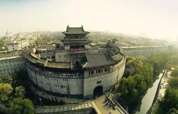
How Rivers and Terrain Made Luoyang City Henan a Seat of Ancient Chinese Capitals
Why did successive dynasties keep returning to the same patch of land in central China to build their capitals? That’s the question anyone researching Luoyang city Henan runs into almost immediately. The answer isn’t political accident — it’s geography. Luoyang sits at a junction where rivers, plains, and mountain corridors converge in a way that made it defensible, farmable, and reachable, all at once. Understanding that physical setup explains more about Chinese dynastic history than most textbook timelines do.
Located in the western part of Henan province, Luoyang occupies a basin framed by mountain ranges to the north and south, with the Luo River running through its heart before joining the larger Yellow River basin nearby. This combination — river access, mountain shelter, and open farmland — is the actual reason the city became one of the recognized ancient Chinese capitals, not just a footnote in dynastic records.
Where Luoyang Sits Within Henan Province
Henan province occupies the southern edge of the North China Plain, and Luoyang lies roughly in its western-central section, closer to the Shanxi and Shaanxi borders than to Henan’s eastern flatlands. This placement matters more than it might seem at first glance.
- Distance from the Yellow River: Luoyang sits about 25 kilometers south of the Yellow River’s main channel, close enough for trade and water access, far enough to avoid the worst flood cycles.
- Elevation context: The city occupies a basin at higher elevation than the eastern Henan plains, giving it natural drainage advantages during monsoon season.
- Regional connectivity: It sits near the historical routes linking the Guanzhong region (around modern Xi’an) to the eastern plains, making it a natural midpoint for administrators moving armies, grain, or officials.
If you’re mapping Luoyang geography for research purposes, the key takeaway is this: the city isn’t in the geographic center of Henan, but it is at a strategic pivot point between the mountainous west and the open east — a position that repeatedly mattered more than raw centrality.
How the Luo River, Yellow River Corridor, Plains, and Mountain Routes Shaped Luoyang’s Strategic Rise
This is the part most general city profiles skip, and it’s the part that actually explains the “why” behind Luoyang’s repeated selection as a capital. Four geographic elements worked together, and getting any one of them wrong — from a planner’s perspective — would have undermined the whole site.
| Geographic Feature | What It Actually Provided | What Would Go Wrong Without It |
|---|---|---|
| Luo River | Direct water supply, irrigation for surrounding farmland, and a transport route connecting the city to the wider river network | Without it, the settlement would depend entirely on wells and rainfall — unreliable for supporting a large administrative population |
| Yellow River basin proximity | Access to the broader agricultural heartland and a major transport artery reaching far into north and east China | Being cut off from this corridor would isolate the city from grain shipments and long-distance trade, weakening its role as an administrative center |
| Surrounding plains | Fertile, flat land for grain production sufficient to feed a capital-sized population plus surplus for taxation and storage | Insufficient farmland nearby means constant grain shortages and dependency on distant, harder-to-secure supply lines |
| Mountain routes (north and south) | Natural defensive barriers plus controlled passes that could be garrisoned against invasion | Open, unprotected terrain would leave the capital exposed to raids and make it far costlier to defend militarily |
Here’s the practical logic dynastic planners followed, whether or not they wrote it down explicitly: a capital needs food, water, defense, and connectivity — in that order of daily importance, but roughly reversed in terms of long-term survival value. Luoyang delivered all four without forcing a trade-off. Compare that to a river-adjacent site with no mountain shelter — vulnerable to attack from open plains — or a mountain fortress with poor farmland nearby, which would be defensible but unable to feed itself. Luoyang’s basin avoided both failure modes.
This is also why the city cycles in and out of capital status across Chinese history rather than holding the role permanently. When political power shifted westward toward the Guanzhong basin, or eastward toward the coastal regions, Luoyang’s advantages became relatively less critical. But whenever a dynasty needed a defensible, food-secure, well-connected base in central China, this same river-and-mountain configuration made it the default candidate again.
Why Luoyang Was Chosen as an Ancient Capital — The Recurring Pattern
Multiple dynasties, across centuries, arrived at the same conclusion independently. That pattern is worth examining directly rather than treating it as a coincidence.
- Eastern Zhou dynasty relocated its capital to Luoyang after the original western base became militarily untenable — river and mountain protection mattered more once external threats increased.
- Eastern Han dynasty chose Luoyang over the earlier Chang’an site partly because of accumulated damage and instability at the older capital, and partly because Luoyang’s agricultural base could support the administrative population.
- Northern Wei and later dynasties returned to the site repeatedly, reinforcing infrastructure that earlier rulers had already built — canals, road networks, and granaries tied to the Luo River system.
The common thread: none of these choices were purely symbolic. Each dynasty needed the same practical combination — water, food, defense, transport — and Luoyang kept satisfying that checklist better than most alternatives in central China.
Common Misconceptions Researchers Should Avoid
- Mistake: Assuming Luoyang was chosen mainly for symbolic or ceremonial reasons. Reality: Symbolic value followed practical viability, not the reverse.
- Mistake: Treating “Yellow River city” and “Luo River city” as interchangeable descriptions. Reality: Luoyang’s direct water source is the Luo River; the Yellow River basin is the wider regional system it connects into.
- Mistake: Assuming the capital status was permanent or uninterrupted. Reality: Luoyang moved in and out of capital status multiple times, based on shifting military and political priorities.
A Practical Framework for Understanding Luoyang’s Geography in Research or Travel Planning
If you’re approaching this topic for academic research, cultural travel planning, or content development, here’s a simple checklist to keep the geography straight:
- Confirm the river distinction: Note that the Luo River runs through the city directly, while the Yellow River lies to the north as part of the wider basin system.
- Map the mountain framing: Identify the northern and southern ranges that historically provided defensive cover — this context explains military decisions in dynastic records.
- Check the plains extent: The farmland surrounding the basin is what allowed population density high enough to sustain a capital-level bureaucracy.
- Cross-reference dynastic timelines: Match periods when Luoyang held capital status against the wider political landscape of China connect the geography to the history
accurately.
For readers building out a broader itinerary or research trail, it also helps to look at how Luoyang connects historically to other regional centers — the routes linking it to the Guanzhong basin, for instance, or the trade paths running east toward the coast. Understanding those connections gives a fuller picture than looking at Luoyang in isolation.
Frequently Asked Questions
Why was Luoyang an ancient capital?
Luoyang combined four practical advantages rarely found together: direct river access via the Luo River, farmland extensive enough to feed a large population, defensible mountain terrain on two sides, and connectivity into the broader Yellow River basin transport network. Dynasties chose it repeatedly because it solved the food-water-defense-connectivity problem simultaneously.
How did rivers shape Luoyang’s development?
The Luo River provided the city’s immediate water supply and irrigation base, while proximity to the Yellow River basin extended its trade and grain-transport reach across a much larger region. Without both, the city couldn’t have sustained the population density required for a capital administration.
Where is Luoyang in Henan province?
Luoyang sits in the western-central part of Henan province, south of the Yellow River’s main channel and within a basin bordered by mountain ranges to the north and south — a position closer to the historical Guanzhong corridor than to Henan’s eastern plains.

For teams researching the region for cultural documentation, exhibition content, or sourcing regional historical references, feel free to reach out for a detailed briefing document or supporting map assets tailored to your project scope.
About LyWOW Tours
LyWOW is a locally based travel agency in Luoyang, specializing in private tours for international travelers across Luoyang, Shaolin, Xi’an and Central China. English-speaking guides, flexible itineraries and door-to-door service.
Learn more about us or browse all our tours.