Luoyang in China Holds Three Overlapping Capital Layers That Shape How You Plan Your Visit
Why does a single city in Henan province contain three separate “ancient capitals” that don’t sit on top of each other, but spread across a stretch of the Yi-Luo river basin? That’s the question most researchers and history travelers ask once they start reading about Luoyang’s archaeological zones. The confusion is understandable. Luoyang in China isn’t one excavation site — it’s a sequence of capital cities built, abandoned, and rebuilt at different points along the same river corridor over roughly a thousand years. Each layer served a different dynasty, sat in a different location, and left behind a different type of physical evidence. If you don’t separate them before you arrive, you’ll spend a day driving between sites that have nothing to do with each other historically.
This guide breaks down the three main layers — Eastern Zhou, Han-Wei, and Sui-Tang — so you can decide which ruins actually match your research interest or travel itinerary.
Why Luoyang Has Three Separate City Sites Instead of One
Chinese capitals were rarely rebuilt on the exact same footprint. Flooding, shifting political priorities, and the practical need for fresh building material meant each new dynasty often moved the city center a few kilometers up or down the valley. Luoyang’s location — flanked by mountains and sitting at the junction of the Yi and Luo rivers — made it a repeatedly attractive capital site, which is why you get multiple layers instead of continuous reuse of one city wall. The Eastern Zhou dynasty picked one spot, the Han and Wei dynasties picked another several kilometers northeast, and the Sui-Tang rulers moved again to a location closer to the modern city center. Understanding this geographic drift is the first step to planning a sensible visit.
Comparing the Eastern Zhou, Han-Wei, and Sui-Tang Layers
The table below lays out the three layers side by side — location relative to modern Luoyang, what physically remains today, and the historical role each city played.
| City Layer | General Location | Surviving Remains | Historical Role |
|---|---|---|---|
| Eastern Zhou Capital | West of the modern city, near present-day Jianxi district | Rammed-earth wall foundations, scattered palace platform traces, tomb clusters identified through excavation | Seat of the Zhou royal court during a period of fragmented regional power; mostly known through archaeological survey rather than standing structures |
| Han-Wei City | East of the modern city, on the north bank of the Luo River | Large sections of city wall earthworks, gate foundations, and the outline of palace precincts still visible as raised ground | Capital under the Eastern Han and later the Wei and Western Jin courts; one of the longest continuously used capital sites in the valley |
| Sui-Tang City | Closer to the modern downtown, straddling both banks of the Luo River | Reconstructed gate structures, excavated palace hall foundations, portions open as an archaeological park | Eastern capital of the Sui dynasty and a secondary imperial seat under the Tang, reflecting the empire’s expanded urban planning ambitions |
Notice that none of these three sites overlap on the ground. That’s precisely why visitors who expect “one old town” get disoriented — you’re really comparing three separate archaeological zones, each requiring its own trip.
What Each Layer’s Location Actually Affects When You Plan a Visit
Knowing the period name isn’t enough. What matters practically is how each layer’s location and preservation state affects your actual day on the ground. Get these details wrong and you’ll either waste a half-day driving to a field with no visible structure, or miss the one site that matches your specific research angle.
Distance between sites
The Eastern Zhou and Han-Wei sites sit on opposite sides of modern Luoyang, roughly a 40-50 minute drive apart depending on traffic. Trying to see both in one afternoon, plus the Sui-Tang park downtown, usually means you rush all three and absorb none properly. If your goal is serious research rather than a quick photo stop, plan one site per half-day block.
What “surviving remains” really means on site
The Eastern Zhou location is the least visually dramatic — you’re often looking at raised earth and interpretive signage rather than standing walls. If you need photographable ruins for a presentation or documentary, the Han-Wei wall sections or the Sui-Tang reconstructed gates will serve you far better than the Zhou layer. Buyers of a “complete ancient capital experience” who skip this distinction often leave disappointed at the Zhou site specifically.
Seasonal access and ground conditions
Because several zones are open excavation fields rather than paved museum grounds, heavy rain season can make walking paths muddy or temporarily close access roads. If your visit window is narrow, checking current site conditions before traveling out to the Han-Wei or Zhou areas avoids a wasted trip — the Sui-Tang park, being more developed, is less affected by this.
Common Mistakes When Sequencing a Multi-Layer Visit
- Treating the three sites as one attraction. They require separate transport legs and separate time blocks — not a single ticket or a single walking tour.
- Visiting in dynasty order instead of geographic order. Chronological order (Zhou, then Han-Wei, then Sui-Tang) often means backtracking across the city. Group visits by proximity instead, then read about the history in order afterward.
- Assuming all three sites have equal visitor infrastructure. The Sui-Tang park has the most developed facilities; the Eastern Zhou site is the most research-oriented and least set up for casual visitors.
- Skipping local museum stops. Artifacts excavated from all three layers are often housed in city museums rather than at the original site, so a museum-only itinerary can actually cover more ground than site-hopping.
A Practical Step-by-Step Approach for Researchers and History Travelers
- Decide which dynasty’s history matters most to your project — this determines which single layer deserves the most time.
- Check which museum in the city holds artifacts from that layer, and visit the museum before the physical site, so you understand what you’re looking at on the ground.
- Group the Han-Wei and Eastern Zhou site visits on separate days, given the driving distance between them.
- Save the Sui-Tang archaeological park for a half-day on its own, since it has more to see per hour spent.
- Build in a buffer day if you’re visiting during rainy months, in case excavation-field access is affected.
Decision Checklist Before You Commit Your Itinerary
- Is your interest primarily textual/political history (Zhou era) or urban planning and imperial architecture (Sui-Tang)? This should drive which site gets priority time.
- Do you need visually strong material for photography or presentation? Favor Han-Wei wall sections and the Sui-Tang park over the Zhou site.
- How many days do you realistically have? One layer per half-day is a safer estimate than trying to combine two in one afternoon.
- Will you need museum context first? If yes, schedule museum visits before the matching excavation site.
Researchers studying the broader context of Chinese capital planning often cross-reference these three layers with other early dynastic capitals discussed on general historical references for Luoyang, which helps place the city’s repeated reuse in a wider pattern of Chinese urban history.
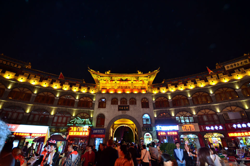
Once you’ve mapped out which layer matches your research focus, the logistics become much simpler. Luoyang in China rewards travelers who treat it as three distinct historical stops rather than one blended old town — the sites simply don’t share a footprint, and neither should your schedule.
If you’re planning a research trip or need help sequencing a multi-site itinerary across these three layers, reach out with your travel dates and interests — we’re happy to suggest a realistic route based on what’s currently accessible.