By
By Plan Luoyang by Dynasty Through Its Ancient Capital Landscapes
Which ancient capital should you look for when visiting Luoyang? The answer changes with the dynasty. A visitor who assumes that every imperial ruin stands in one preserved walled city will miss the real historical pattern: royal and imperial centers shifted across the Luo River basin, often reusing strategic ground while changing the city’s layout, ceremonial axis, and defensive position.
Luoyang was a capital for multiple ruling houses, but it was not one fixed capital site. Eastern Zhou rulers established royal centers in the western urban area. Eastern Han, Cao Wei, Western Jin, and Northern Wei courts used a major city farther northeast. Sui and Tang rulers then developed an eastern capital whose administrative and ceremonial geography deserves its own reading. The practical result is simple: plan by dynasty first, then choose archaeological areas and museums that match that period.
Use the ruling dynasty to choose the right historical area
The most useful starting point is not a generic city map. It is a dynasty map. Each period answers a different question about how power was organized: Zhou rulership and ritual order, Han imperial administration, Northern Wei political transformation, or Tang-era metropolitan expansion.
| Ruling era | Capital role | Primary area to place on your map | What the location reveals | Best fit for |
|---|---|---|---|---|
| Eastern Zhou | Royal capital centers associated with Wangcheng and Chengzhou | Western and central urban Luoyang, including the Wangcheng area | The early political landscape of the Zhou court and its relationship to the Luo River plain | Visitors focused on classical China, ritual culture, and early state formation |
| Eastern Han | Imperial capital from 25 to 190 | Northeast of the modern urban core, in the Han-Wei city area | A planned imperial city with palace, government, and market zones beyond the modern downtown | Readers interested in Han government, Silk Road-era exchange, and imperial urban planning |
| Cao Wei and Western Jin | Successive imperial capitals using the Han-Wei urban zone | Han-Wei city archaeological area | Political continuity after the Han collapse, alongside rebuilding and changing court priorities | Three Kingdoms and early medieval history itineraries |
| Northern Wei | Capital after the court moved south in 493 | Expanded Han-Wei city area and the wider northern approach to the city | A northern dynasty adapting imperial institutions in a major Central Plains capital | Visitors connecting city history with Buddhist art and the Longmen area |
| Sui and Tang | Eastern capital, often called Dongdu in relevant periods | Eastern and northeastern parts of the historic urban landscape | A large metropolitan capital functioning alongside Chang’an and, at times, holding exceptional political importance | Travelers studying Tang politics, court ceremony, and urban scale |
| Later Tang | Capital during the Five Dynasties period | The inherited eastern-capital landscape | The continued strategic value of the city after the Tang dynasty ended | Visitors looking beyond the better-known high imperial periods |
Recommendation: begin with a dynasty you genuinely want to understand, then add nearby sites from the same historical layer. This approach fits visitors with limited time because it prevents a scattered itinerary. It does not suit travelers whose main goal is simply scenic sightseeing; in that case, a broader route combining museums, parks, and major monuments may be more enjoyable.
Compare the changing locations instead of treating imperial history as one site
The central planning mistake is treating Luoyang’s imperial history as a single point on a map. Its capital cities were related, but they were not identical. Their movement reflects changes in security, river access, terrain, court ritual, urban growth, and the political needs of different dynasties.
| Capital landscape | Relative position in modern Luoyang | Ruling eras most closely associated with it | What happens if you place it incorrectly |
|---|---|---|---|
| Wangcheng and Zhou royal landscape | Western and central side of the modern city | Eastern Zhou | You may read later imperial ruins as Zhou remains and lose the distinction between early royal capitals and later dynastic cities. |
| Han-Wei city | Northeast of the modern urban core | Eastern Han, Cao Wei, Western Jin, Northern Wei | You may overlook the core landscape for several centuries of imperial rule and incorrectly assume that all major remains sit near modern commercial districts. |
| Sui-Tang eastern-capital landscape | Eastern and northeastern historical zones, shaped by earlier occupation and later development | Sui, Tang, and later political use | You may flatten a changing urban system into a single “Tang city,” missing how the eastern capital’s status varied by ruler and period. |
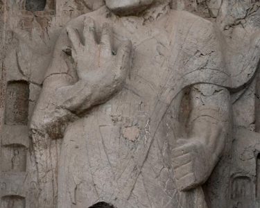
| Longmen river corridor | South of the central city along the Yi River | Especially significant for Northern Wei and Tang religious patronage | You may mistake a major religious and artistic landscape for the physical location of every imperial palace or government office. |
Conclusion: map the capital zone and the associated cultural landscape separately. The Han-Wei city area is essential for understanding several imperial courts, while Longmen is essential for understanding state-supported Buddhist art and elite patronage. They belong in the same historical itinerary, but they serve different interpretive purposes.
This distinction matters most for readers preparing a serious heritage visit, student research trip, guided program, or cultural itinerary. It is less necessary for a short stop focused only on headline attractions, although even then it helps explain why sites are spread across different parts of Luoyang.
Read each capital layer through the practical features that shaped it
A historical map becomes useful when each feature has a practical meaning. Do not merely memorize names such as Wangcheng, Han-Wei City, or Dongdu. Ask what each feature did for the ruling court and what a mistaken interpretation would change.
- River relationship: The Luo River and nearby waterways supported movement, settlement, and agricultural access. If you ignore river geography, a capital’s location can seem arbitrary. Use a modern map with waterways visible, but remember that river courses and urban edges have changed over time.
- Palace-city position: Palace districts expressed hierarchy and controlled access to the ruler. Confusing a palace zone with the full city makes ancient capitals appear much smaller than they were. This matters when interpreting archaeological maps that show walls, gates, and administrative compounds separately.
- Wall lines and gates: City walls established defense, movement control, and ceremonial routes. A gate was not simply an entrance; it could organize processions, trade flows, and the relationship between inner and outer urban spaces. Do not assume visible modern roads follow ancient walls exactly.
- Burial landscapes: Tombs often lie outside city centers and can reveal elite networks, political rank, and changing funerary practices. A tomb site should not automatically be described as part of the capital itself, even when it is critical evidence for that dynasty.
- Religious monuments: Temples, grottoes, and steles show patronage and belief, but they may stand beyond the administrative core. Their location can reveal a broader sacred geography rather than the city’s governing center.
Recommendation: carry two map layers when researching Luoyang: a present-day transport map and a historical-period map. The first helps with access; the second prevents chronological confusion. This method is especially effective for independent visitors. It has limits when a site has restricted access, limited interpretation, or remains visible only through museum displays rather than standing structures.
Build a dynasty-based route before choosing individual attractions
A coherent route should have one historical question. “How did the capital move from Zhou royal rule to later imperial systems?” is a better question than “What are the top places in the city?” The first question gives every stop a purpose.
- Select one primary era. Choose Eastern Zhou, Han through Northern Wei, or Sui-Tang history. Avoid trying to master every dynasty in a single day.
- Mark the appropriate capital landscape. Place Wangcheng for Eastern Zhou study, the Han-Wei city area for Han through Northern Wei, or eastern-capital locations for Sui and Tang research.
- Add one evidence site. Choose a museum, archaeological park, tomb-related display, or religious monument that helps interpret the chosen era.
- Add one comparison point. For example, pair the Han-Wei city landscape with Longmen to compare political capital space and religious patronage.
- Check modern travel time and site access. Ancient geography does not equal modern convenience. District boundaries, road conditions, opening arrangements, and seasonal conditions can shape the actual route.
- Record what is reconstructed, excavated, or interpreted. A reconstructed gate, an exposed foundation, and a museum model offer different kinds of evidence. Treat them differently in notes and photographs.
For a first visit, a practical combination is the Wangcheng area for the Eastern Zhou layer, a dedicated study of the Han-Wei city landscape for later imperial continuity, and a separate visit to Longmen for Northern Wei and Tang religious art. This is a comparison route, not a claim that these places formed one simultaneous capital. It works well for readers who have at least a full day and want context. It does not work well if travel time is too short or if the goal is only a relaxed scenic outing.
Avoid the common mistakes that blur the city’s historical geography
- Mistake: calling every historical area “the ancient capital.” Use the dynasty and site name together. Say “Eastern Zhou Wangcheng landscape” or “Han-Wei city area” whenever possible.
- Mistake: assuming capital status was uninterrupted. The city’s importance was substantial across many periods, but its political role changed. Check the precise ruling era before describing it as the capital.
- Mistake: equating Longmen with the imperial city. Longmen is indispensable for understanding art, religion, and patronage, yet it is not a substitute for mapping palace and administrative zones.
- Mistake: relying on one modern landmark to explain all periods. Modern urban landmarks are useful navigation points, not proof of ancient boundaries.
- Mistake: reading archaeological remains as complete cities. Excavated foundations and surviving features are partial evidence. Use plans, captions, and museum interpretation to understand what is absent as well as what is visible.
The best plan for Luoyang is therefore chronological before it is geographic. Identify the ruling dynasty, locate that dynasty’s capital landscape, and then connect it to relevant archaeological and religious sites. This approach gives the city’s long history a clear structure without reducing centuries of change to one imagined imperial center.
Planning a heritage itinerary or research visit? Request tailored selection advice for a dynasty-based Luoyang route.