 By
By Where Is Luoyang in China: Understanding Its Position in River Geography
If you are trying to pin down where is Luoyang in China, the answer involves more than a dot on a map. Luoyang sits in the western part of Henan Province, where the Luo River flows into the broader Yellow River system. The city occupies a strategic transition zone between the North China Plain and the rugged uplands of western Henan. This positioning shaped its historical role and still affects regional logistics, climate, and access today.
Many travelers and researchers start with a simple question: is Luoyang in central China, northern China, or somewhere in between? The practical answer is that Luoyang lies in the central-north portion of China, roughly 800 kilometers south of Beijing and 400 kilometers west of the coastal city of Lianyungang. But the river geography tells a more precise story.
Boundary: Luoyang Between the Luo River Basin, Yellow River Corridor, and Western Henan
Luoyang’s location is best understood as a boundary zone. Three geographic features converge here, and each one shapes a different aspect of the city’s character.
The Luo River Basin: The Immediate Setting
The Luo River (洛河) flows through the heart of Luoyang. The city developed along the river’s alluvial plain, which provides relatively flat, arable land in an otherwise hilly region. The Luo River basin runs roughly east-west, creating a natural corridor that has funneled movement for centuries. For modern visitors, the river divides the city into northern and southern sections, with most historical sites concentrated near the northern bank.
The Yellow River Corridor: The Larger Frame
About 25 kilometers north of central Luoyang, the Yellow River (黄河) cuts through the landscape. Luoyang does not sit directly on the Yellow River itself. Instead, it occupies a tributary valley that opens onto the Yellow River corridor. This matters for flood risk, irrigation, and transportation. The Yellow River corridor historically connected Luoyang eastward to Zhengzhou and Kaifeng, and westward toward the Sanmenxia Gorge. The Yellow River system made Luoyang a natural hub rather than an isolated settlement.
Western Henan: The Upland Context
To the west and southwest of Luoyang, the terrain rises into the Xiong’er Mountains and Funiu Mountains. These uplands form part of the transition from the North China Plain to the Loess Plateau. This means Luoyang sits at the edge of two worlds: the flat, densely populated plains to the east, and the more fragmented, erosion-prone highlands to the west. The city functions as a gateway between these zones.
| Geographic Feature | Direction from Luoyang | Practical Effect |
|---|---|---|
| Luo River basin | Center, east-west axis | Flat land for urban development, historical water supply |
| Yellow River corridor | North, ~25 km away | Regional transport link, floodplain boundary |
| Western Henan uplands | West and southwest | Natural defense historically, limited flat land for expansion |
| North China Plain | East | Easy access to Zhengzhou, Kaifeng, and coastal routes |
What Luoyang’s River Geography Means for Access and Climate
Understanding where is Luoyang in China helps you anticipate practical conditions. The city’s position between river systems and uplands creates a specific climate profile. Winters are cold and dry, influenced by continental air masses from the interior. Summers are hot and humid, with moisture arriving from the southeast. Spring and autumn are short but generally comfortable.
Rainfall averages between 500 and 700 millimeters annually, concentrated in the summer months. The Luo River basin channels this water, which historically meant irrigation for agriculture but also periodic flood risk. Modern flood control infrastructure along the Luo River and Yellow River has reduced this risk substantially, but the geography still shapes drainage patterns.
Access to Luoyang follows the same corridors that have existed for millennia. The east-west route along the Yellow River valley connects Luoyang to Zhengzhou in about 1.5 hours by high-speed rail. To the north, routes cross the Yellow River toward Jincheng and the Shanxi plateau. To the west, the terrain becomes more challenging, with roads and rail lines following river valleys through the mountains.
Common Misconceptions About Luoyang’s Location
- Misconception: Luoyang is directly on the Yellow River. It is not. Luoyang sits on the Luo River, a tributary. The Yellow River is about 25 kilometers north. This distinction matters for understanding the city’s historical development and current landscape.
- Misconception: Luoyang is in central China’s flat plains. The eastern parts of Luoyang’s administrative area are flat, but the city proper sits at the edge of uplands. Western Luoyang districts rise into mountainous terrain.
- Misconception: Luoyang’s river geography is only historically relevant. The same corridors still determine modern rail lines, highway routes, and industrial zones. Ignoring the geography leads to poor logistics planning.
- Misconception: The Luo River is a minor stream. The Luo River is a significant tributary of the Yellow River, draining a large area of western Henan and eastern Shaanxi. It has shaped settlement patterns for thousands of years.
How River Geography Shapes Luoyang’s Districts and Landmarks
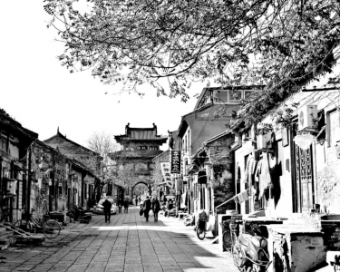
If you plan to visit Luoyang or research its historical sites, the river geography explains why things are where they are. The old city center developed on the north bank of the Luo River. This area, including the Old Town and Lijing Gate, sits on slightly elevated ground that offered protection from flooding while remaining close to water.
The Longmen Grottoes, one of Luoyang’s most famous sites, sit about 12 kilometers south of the city center. They were carved into limestone cliffs along the Yi River, another tributary that joins the Luo River south of the city. The site’s location reflects deliberate selection: the river gorge provided both a durable rock face and a scenic setting. The Longmen Grottoes are a UNESCO World Heritage Site precisely because of this geographic and artistic convergence.
The White Horse Temple, often cited as China’s first Buddhist temple, lies about 12 kilometers east of central Luoyang. Its location on the eastern approach to the city placed it along the traditional route from the Yellow River crossing to the Luo River basin. This positioning made it accessible to travelers arriving from the east without requiring them to enter the city itself.
A Practical Framework for Understanding Luoyang’s Position
For anyone verifying where is Luoyang in China before traveling or researching, a simple framework helps. Think of Luoyang as a node where three geographic systems meet: the east-west Yellow River corridor, the north-south Luo River valley, and the east-west transition from plain to upland. This framework explains settlement patterns, transportation routes, and climate.
The city’s administrative boundaries extend far beyond the urban core. Luoyang municipality covers approximately 15,200 square kilometers, making it one of the larger prefecture-level cities in Henan. The urban districts occupy the Luo River valley floor, while the surrounding counties extend into the mountains to the west and south. This means that “Luoyang” can refer to a compact urban area or a much larger administrative region, depending on context.
Step-by-Step: Verifying Luoyang’s Position on a Map
- Locate Henan Province in central-north China. It sits south of the Yellow River and north of Hubei Province.
- Find the Yellow River flowing east-west through northern Henan. Luoyang is south of this river, not directly on it.
- Identify the Luo River flowing eastward into the Yellow River. Luoyang occupies the middle section of this river’s valley.
- Note the terrain change west of Luoyang. Elevations rise sharply as the North China Plain gives way to the Loess Plateau and mountain ranges.
- Confirm the administrative position: Luoyang is the westernmost major city in Henan Province, bordering Sanmenxia to the west and Zhengzhou to the east.
Why Luoyang’s River Position Still Matters for Logistics and Planning
The geographic logic that made Luoyang a historical capital still operates today. The east-west river corridor remains the primary route for rail and highway connections. The north-south Luo River valley provides a natural approach from the Yellow River into the interior. The western uplands, while limiting expansion, also provide water catchment and mineral resources.
For businesses or researchers planning projects in Luoyang, the river geography affects several practical decisions. Site selection for industrial facilities must account for floodplain restrictions along the Luo River. Transportation planning should consider that east-west routes are generally faster and more developed than north-south routes. Water availability varies significantly between the river valleys and the upland areas.
Climate planning also follows the geography. The river valleys experience more moderate temperatures than the surrounding hills. Fog and air quality issues can be more pronounced in the valley bottoms, particularly in winter. Understanding these patterns helps with scheduling visits, locating facilities, or planning outdoor research activities.
If you need more specific information about Luoyang’s geographic position for a research project, travel plan, or business decision, we can provide detailed regional context and route guidance. Contact our team with your specific location-related questions, and we will help you understand how Luoyang’s river geography applies to your situation.