By
By A Practical Guide to Navigating Luoyang China’s Districts and Heritage Sites
Planning a trip to Luoyang, China, presents a unique geographical challenge. The city’s profound history, spanning multiple dynasties and ancient capitals, is layered over a modern, sprawling metropolis. For first-time visitors, especially those on a tight business schedule, understanding how the modern city layout relates to its scattered, world-class heritage sites is the key to an efficient and rewarding trip. Without a clear mental map, it’s easy to misjudge travel times and misunderstand the sheer scale of the region’s historical footprint.
This guide provides a framework for orientation. We will break down the city’s structure by its main districts and natural boundaries, showing you how to connect the dots between ancient history and contemporary urban life. By understanding the city’s zones, you can build a logical itinerary that minimizes transit time and maximizes your experience of this historic center of Chinese civilization.
Understanding Luoyang’s Core Geography: The Luo River and Urban Districts
The first step in navigating Luoyang is to recognize its primary geographical feature: the Luo River, which flows west to east through the city’s heart. This river acts as a natural dividing line. Most of the central urban core and key historical sites are located on the river’s northern and southern banks. The modern city is primarily composed of several key districts, each with a distinct character. Understanding these districts helps in choosing accommodation and planning daily travel.
For visitors, the four most relevant central districts are Jianxi, Xigong, Laocheng, and Chanhe. While they blend into one another, knowing their general purpose is crucial for orientation.
Key Urban Districts at a Glance
This table provides a simple breakdown of the main urban districts and their relevance for a visitor. Use this to decide where to stay or focus your time based on your trip’s objectives.
| District | Primary Character | Relevance for Visitors | Key Landmarks / Features |
|---|---|---|---|
| Jianxi (涧西区) | Industrial & Modern Commercial | Important for business travelers visiting industrial facilities. Contains modern shopping centers and hotels. | Modern commercial plazas, industrial parks. |
| Xigong (西工区) | Central Business District | The modern heart of the city. Excellent transport links, major hotels, restaurants, and the main railway station. | Wangcheng Park, Luoyang Railway Station, department stores. |
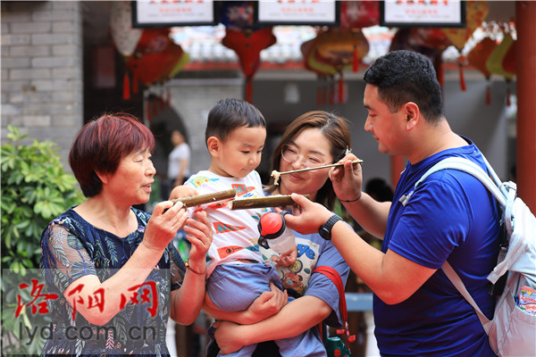
| Laocheng (老城区) | “Old Town” (Ming/Qing Era) | The primary tourist hub for local culture, food, and atmosphere. Features restored ancient-style streets. | Lijingmen Gate, Luoyang Old Street (for food and souvenirs), Drum Tower. |
| Chanhe (瀍河区) | Residential & Historical | Home to a significant historical site and offers a more local, residential feel. | White Horse Temple is located in the eastern part of this district’s administrative area. |
A common mistake is assuming that “Laocheng” (Old Town) is the site of Luoyang’s most ancient capitals, like the Han or Tang dynasties. Laocheng primarily reflects the architecture and layout of the much later Ming and Qing dynasties. The ruins and archaeological parks of the earlier, more famous capitals are located outside this historic-themed district.
Connecting Ancient Capitals with the Modern City
The biggest challenge in Luoyang is that its “history” isn’t in one place. The city served as the capital for numerous dynasties, and each one built its capital in a slightly different location in the surrounding river basin. These ancient sites are now vast archaeological parks or monumental landmarks situated within or on the outskirts of the modern districts. To navigate effectively, you need a strategy that uses the modern city’s infrastructure to bridge these historical zones.
Here is a step-by-step process for connecting the modern city of Luoyang, China, with its ancient heritage zones.
A 3-Step Process for Geographical Orientation
- Anchor Your Map to the Rivers: Start by identifying the Luo River and, further south, the Yi River. The most famous site, the Longmen Grottoes, is located on the banks of the Yi River, south of the main urban core. The ancient Han-Wei and Sui-Tang capital sites are situated around the Luo River. Using these two rivers as your primary north-south anchors prevents confusion.
- Differentiate the “Capitals”: Mentally separate the heritage sites into distinct historical zones. The Sui-Tang Dynasty City National Archaeological Park (covering the imperial city area of that era) is located in the central-southern part of the modern city. The ruins of the earlier Han and Wei dynasty capital are further east, near the White Horse Temple. The Ming-Qing “Old Town” (Laocheng) is a third, separate entity. Don’t treat them as a single “historic area.”
- Use Major Transit Corridors as Connectors: Identify the main east-west and north-south avenues and metro lines. For instance, major boulevards like Zhongzhou Road run through the heart of the city, providing a direct path connecting western commercial districts with the central and eastern zones. The Luoyang Metro, particularly Line 2, provides a crucial north-south link connecting the main railway station area directly to the vicinity of the Sui-Tang sites. Use these modern arteries to hop between the scattered historical zones.
Common Navigational Mistakes to Avoid
Failing to plan around Luoyang’s geography can lead to wasted time and a frustrating experience. Here are common pitfalls to watch out for.
- Underestimating Distances: The major heritage sites are miles apart. The Longmen Grottoes are about 12 km south of the city center, and the White Horse Temple is about 12 km east. These are not walkable distances and require dedicated travel time via taxi, bus, or metro.
- Confusing Laocheng with Ancient Capital Ruins: Visitors often spend all their time in the Laocheng “Old Town” district, believing they are in the heart of ancient Luoyang. While charming, it represents only the city’s later history. The globally significant sites of older dynasties are separate locations.
- Ignoring the River as a Guide: Getting disoriented is easy if you don’t use the Luo River as a constant reference point. Knowing whether you are north or south of the river immediately helps you place yourself on the map relative to major districts and sites.
- Not Leveraging Public Transit: Relying solely on taxis can be inefficient and costly. The city’s public bus network is extensive, and the metro system is a clean, fast way to cover long north-south distances, bypassing city traffic.
A Zonal Approach to Building Your Luoyang Itinerary
To create an efficient travel plan, group attractions by geographic zone. This minimizes backtracking and allows you to explore clusters of related sites in a single trip. A business traveler with only one or two free days can use this approach to see the absolute highlights without spending half their time in transit.
Here’s a logical breakdown of Luoyang’s main attractions by zone:
Zone 1: The Southern Corridor (Yi River)
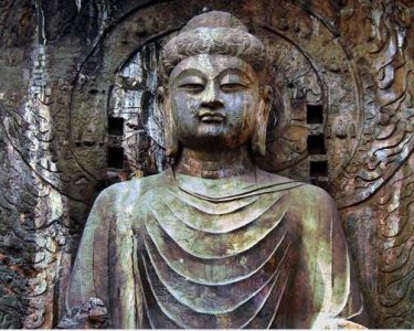
- Primary Site: Longmen Grottoes. This UNESCO World Heritage site is a must-see. It requires at least half a day to explore properly.
- Logistics: Located south of the main city. Accessible via taxi, tourist bus, or by taking the metro part of the way and transferring. Plan this as a dedicated trip.
Zone 2: The Eastern Corridor
- Primary Sites: White Horse Temple (often cited as the first Buddhist temple in China) and the Han-Wei Luoyang Ancient City Ruins.
- Logistics: These sites are located east of the main urban center. It’s practical to visit them together on the same day due to their relative proximity.
Zone 3: The Central Urban Core
- Primary Sites: Luoyang Museum, Sui-Tang Dynasty City National Archaeological Park, and the Laocheng District (Old Town).
- Logistics: These attractions are within the modern city limits. You can visit the museum and the Sui-Tang park during the day, then explore the lively Laocheng district for dinner and evening atmosphere. They are well-connected by public transport.
By dedicating a day or half-day to each zone, you can see the best of what Luoyang has to offer in a structured, logical way. A typical two-day sightseeing plan might dedicate Day 1 to the Southern and Central Zones (Longmen in the morning, Museum/Sui-Tang Park in the afternoon) and Day 2 to the Eastern Zone and a deeper exploration of Laocheng.
For any questions regarding business logistics or planning a corporate visit to the region, our team can provide local insights. Contact us for assistance with your arrangements.