By
By Map China Luoyang Rivers and Historic Districts Before Building an Itinerary
Where are Luoyang’s major heritage areas in relation to its rivers, ancient capitals, and modern urban districts? That is the practical question first-time visitors need to answer before selecting hotels, booking transport, or grouping attractions into realistic day routes. A map of china luoyang becomes much easier to read when you separate three layers: the Yellow River to the north, the Luo River through the urban area, and the modern district names used for today’s addresses.
Luoyang was the location of several historic capitals across different dynasties, but those capital sites do not all sit in one walkable historic center. The city’s heritage landscape extends across a broad area. Longmen is south of the main urban core, White Horse Temple is to the east, and northern areas lead toward sites associated with earlier capital periods and the Yellow River corridor. Planning by attraction name alone often produces poor routing.

Use the Luo River, Yellow River, and modern districts as your orientation framework
The most reliable way to orient yourself in china luoyang is to begin with permanent geographic anchors rather than dynasty names. The Luo River is the principal east-west reference line for the central urban area. The Yellow River lies farther north and should be treated as a northern regional boundary, not as a river beside most central sightseeing sites. Modern district labels then help convert historic locations into usable transport and accommodation decisions.
Use the following comparison before placing any heritage site on your itinerary.
| Map anchor | How to use it | Historic areas it helps locate | Best planning scenario | Limit to remember |
|---|---|---|---|---|
| Luo River | Treat it as the central east-west divider for the modern city area. | Old-city areas, central districts, southern routes toward Longmen, and several ancient-city locations. | Choosing whether two attractions can fit on the same day. | Ancient city boundaries changed over time, so the river alone does not identify one dynasty’s capital site. |
| Yellow River | Use it as a northward orientation point beyond the main urban core. | Northern archaeological landscapes, Mangshan-area sites, and routes leaving the central city. | Planning a dedicated northern excursion. | Do not assume Yellow River sites are convenient add-ons to Longmen or Old City visits. |
| Modern district layout | Check the district shown on the attraction address and compare it with your hotel location. | Luolong, Laocheng, Chanhe, Jianxi, Xigong, and northern suburban areas. | Booking accommodation and estimating transfers. | District boundaries are administrative tools, not the same thing as ancient capital boundaries. |
Conclusion: build your route around rivers and present-day districts first, then add dynasty history. This approach fits first-time visitors who need practical navigation. It does not replace a site-specific map when visiting a large archaeological park, where entrances and walking routes may differ from the broader city map.
The Longmen Grottoes, for example, are south of the main central urban area along the Yi River corridor. The Yi River is a tributary within the broader Luo River system, so it is useful as a local landmark after you have first located the Luo River on a city-scale map.
Follow a five-step mapping procedure before booking your daily routes
Visitors should map sites in a fixed sequence. Starting with attractions and only later checking geography is the main reason heritage itineraries become unnecessarily rushed.
- Mark the Luo River across your map. Find its east-west path through the urban area and use it to distinguish north-bank and south-bank destinations. This is most useful when comparing Old City, central urban districts, and southern cultural sites. It is less useful for destinations far north near the Yellow River.
- Place your hotel before placing attractions. Record the hotel’s modern district, nearest transit connection, and whether it is north or south of the Luo River. This gives you a real starting point each morning. Do not select a hotel solely because its listing says “near ancient Luoyang”; that description may refer to a broad cultural area rather than walking distance.
- Group destinations by direction, not by dynasty. Put Longmen and other southern destinations in one group, eastern destinations such as White Horse Temple in another, and northern archaeological landscapes in a third. This suits visitors with limited days. It does not mean every site in one direction can be completed in a single afternoon.
- Identify the historic period for each capital-related site. Label whether a location relates primarily to Han-Wei, Sui-Tang, Buddhist heritage, or a later urban commercial area. The purpose is to avoid treating “ancient capital” as one physical district.
- Check the actual entrance point and visitor route. Major sites may have gates, shuttle areas, museum sections, or extended walking paths that change the practical journey. Use official visitor information shortly before travel. A pin on a city map is only a starting point.
This procedure gives china luoyang visitors a usable route structure: central and old-city areas can be paired when they are geographically compatible, while Longmen, eastern temple routes, and northern excursions should be evaluated as separate travel blocks. The method is especially valuable when your visit is short. It is less critical for travelers with several flexible days and private transport.
Place the main heritage zones without confusing ancient capitals with today’s city
Luoyang’s historical importance comes from multiple periods, and each period left sites in different locations. A modern map may show one municipality, but it should not be read as a single surviving ancient capital. The table below separates the most useful visitor-level zones.
| Heritage zone | General position | What it represents | Route decision | Common planning limit |
|---|---|---|---|---|
| Longmen area | South of the central urban area, along the Yi River. | Buddhist rock-cut art and a major heritage destination. | Reserve it for a south-focused visit rather than treating it as a quick central stop. | The attraction area requires more on-site movement than a map pin suggests. |
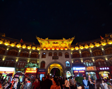
| Luoyang Old City | In the older built-up urban area north of the Luo River corridor. | Later historic streets, urban atmosphere, food, and evening activity. | Pair it with nearby central locations or use it as an evening destination. | It is not identical to every earlier imperial capital site. |
| White Horse Temple area | East of the central city. | A major Buddhist heritage destination associated with early Buddhism in China. | Build an east-focused half-day or full-day plan. | Do not assume it is on the direct route between Old City and Longmen. |
| Han-Wei capital-site landscape | North and northeast of the present central urban area. | Archaeological remains connected with earlier capital periods. | Consider it a northern cultural route with museum or archaeology priorities. | Site remains may be less visually obvious than preserved temples or grottoes. |
| Sui-Tang capital-site landscape | Associated with areas around the modern city and archaeological remains. | Later imperial-city planning and archaeological heritage. | Confirm the specific site name before traveling, because “Sui-Tang Luoyang City” can refer to a wider historical landscape. | Historic labels may cover areas larger than a single visitor entrance. |
Conclusion: use “Old City” for a modern visitor district and atmosphere, while using “Han-Wei” and “Sui-Tang” for historical and archaeological context. This distinction fits anyone building an itinerary around capital history. It does not mean the later Old City lacks heritage value; it simply serves a different mapping purpose.
Build day plans by geographic corridor rather than attraction popularity
A practical itinerary for china luoyang should avoid crossing the city repeatedly. The right grouping depends on your interests, arrival time, and tolerance for walking, but the following route logic is a sound starting point.
- South corridor: choose Longmen as the principal destination. Add another stop only if it is genuinely nearby or your schedule has substantial flexibility. This works for travelers focused on Buddhist art and heritage photography. It does not suit a packed same-day attempt to include northern archaeological areas.
- East corridor: center the route on White Horse Temple and other east-side stops you have verified. This works when religious history is a priority. It does not automatically combine well with a late-evening Old City plan if transport time is tight.
- Central and old-city corridor: use this for urban heritage, markets, museums, and evening walking. This is the most flexible option on arrival day. It does not provide the same archaeological depth as a dedicated ancient-capital route.
- North corridor: reserve this for capital-era archaeology and landscapes closer to the Yellow River direction. It works for visitors who want historical geography rather than only landmark sightseeing. It is not the best choice when you have only a few hours in the city.
For a worked example, a first-time visitor arriving in the afternoon could use the central and old-city corridor first, because it avoids committing to a distant site after travel. The next full day could focus on Longmen in the south. A further day could then be assigned either to White Horse Temple in the east or to northern capital-era sites, depending on whether Buddhist history or archaeological context is the higher priority. This sequence is effective because each day has a clear direction. It is not a fixed timetable; opening arrangements, weather, and local transport conditions should be checked before departure.
Avoid the mapping errors that make Luoyang itineraries confusing
Most route failures in china luoyang come from mixing historical terminology with present-day navigation. Correct these errors before you finalize reservations.
- Mistake: treating every ancient-capital reference as one neighborhood. Ancient capitals expanded, shifted, and changed function over different periods. Use the dynasty or site name, then locate the present-day district and entrance.
- Mistake: using the Yellow River as a central-city landmark. The Yellow River is vital for regional orientation, but it is not beside the core cluster of central visitor sites. Use it to identify northern routes instead.
- Mistake: assuming the Luo River marks a historic border for every period. It is a valuable modern mapping reference, but historical urban boundaries varied. Confirm the archaeological site rather than inferring from river position alone.
- Mistake: booking accommodation near one attraction without checking the rest. A hotel convenient for Longmen may be less convenient for eastern or northern destinations. Compare your full shortlist before booking.
- Mistake: confusing a scenic or commercial Old City visit with an archaeological capital-site visit. Both can be worthwhile, but they answer different interests and require different time expectations.
A useful final checkpoint is to open your map and ask four questions: Is this site north or south of the Luo River? Is it central, east, south, or north of my hotel? Does its historic name identify a precise visitor site or a broader ancient landscape? Can I reach it without crossing the city again later that day? If you can answer those questions, your china luoyang itinerary will be far more coherent.
For historical context, consult the Luoyang reference entry alongside current official visitor information, since historical geography and present-day access details serve different purposes.
Request itinerary-planning advice before finalizing your Luoyang heritage route.