By
By Locate Luoyang City Henan on China’s River Corridors
Where exactly does Luoyang City Henan sit within China’s broader landscape? The answer matters more than a pin on a map. Luoyang’s position between the Yellow River, the Luo River, the surrounding mountain ranges, and the east-west rail corridor explains why the city became a capital for thirteen dynasties and why it still functions as a regional transport node today. If you are a researcher building a geographic baseline or a first-time visitor trying to orient yourself before exploring the Longmen Grottoes or the old town, you need to understand the physical logic of the place first.
Luoyang does not sit directly on the main channel of the Yellow River. That single fact confuses many people. The city core lies roughly 25 kilometers south of the Yellow River’s current course, tucked into a basin where the Luo River and the Yi River converge. The basin itself is framed by mountains on three sides. This is not a flat, open plain like Zhengzhou to the east. It is a defined, enclosed valley with specific entry and exit points — which is precisely why ancient rulers chose it for defense, and why modern rail planners routed key lines through it.
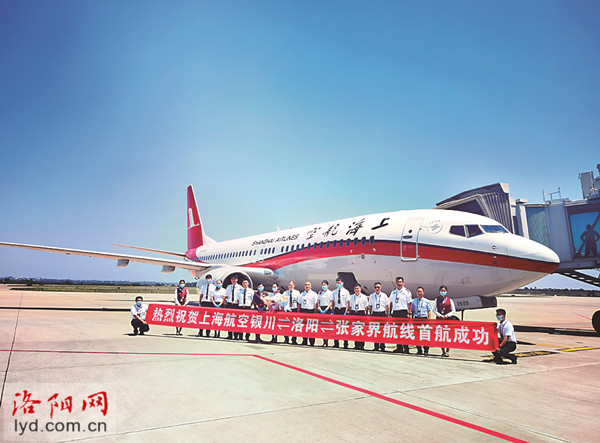
How the Luo River, Yellow River Basin, Mountains, and Rail Corridors Define Luoyang’s Regional Position
To locate Luoyang accurately, you need to separate four geographic systems that intersect here. Each one shapes how the city connects to the rest of China. Getting any of them wrong leads to poor mental models — and for visitors, wasted travel time. Here is the technical breakdown.
The Luo River: The Local Artery
The Luo River is a tributary of the Yellow River, not an independent watercourse. It flows northeast through the basin and joins the Yellow River near the city of Gongyi, east of Luoyang. The Luo is not a large river by Chinese standards — it is a modest, seasonal waterway. But its role is decisive: it provides the flat valley floor where the old city and the modern urban core were built. The city’s name itself — “Luoyang” — means “the sunny (yang) side of the Luo River.” Ancient settlements clustered on the north bank of the Luo to face south, the preferred orientation in Chinese urban planning.
If a visitor assumes Luoyang is a “Yellow River city,” they will look for the big river and fail to find it. The Luo is the waterway you actually see when walking through the old town or along the riverside parks. The Yellow River remains a distant, elevated presence to the north, separated from the city by a band of loess hills.
The Yellow River Basin: The Regional Context
Luoyang belongs to the middle reaches of the Yellow River basin. The term “middle reaches” is not decorative — it denotes a specific section between the upper plateau and the lower floodplain. This middle section is where the Yellow River exits the mountains and begins its long, sediment-heavy journey toward the North China Plain. Luoyang sits near the western edge of that transition zone.
Why does that matter practically? The middle Yellow River carries enormous silt loads. Flooding has historically been severe. But Luoyang’s position slightly removed from the main channel, elevated on the basin floor, gave it a measure of protection that cities directly on the river — like Kaifeng, which has been buried by floods multiple times — never had. For researchers studying settlement patterns, this is the core geographic advantage: proximity to the Yellow River’s transport and agricultural potential without full exposure to its destructive force.
The Mountains: The Natural Fortress
Three mountain systems enclose the Luoyang basin. To the north, the Mangshan hills — low, loess-covered ridges — separate the city from the Yellow River. To the west and southwest, the Xiaoshan and Xiong’er mountains rise more dramatically, part of the eastern extension of the Qinling range. To the southeast, the Songshan massif — famous for the Shaolin Temple — closes the basin’s flank.
The mountain configuration creates a funnel effect. Entry from the east is open and easy, connecting Luoyang to Zhengzhou and the North China Plain. Entry from the west requires passing through narrow gaps — most famously the Hangu Pass and the Tong Pass. These passes were the gates of ancient China. Armies moving from the Wei River valley (modern Xi’an) into the eastern plains had to pass Luoyang. There was no alternative route. That geographic constraint is why Luoyang and Xi’an form a paired axis in Chinese history, and why control of Luoyang meant control of the east-west corridor.
The Rail Corridors: The Modern Spine
Modern infrastructure follows the same logic. The Longhai Railway — China’s great east-west trunk line running from Lianyungang on the coast to Lanzhou in the northwest — passes directly through Luoyang. This is not coincidence. The railway engineers followed the same corridor that ancient roads and canals used: the narrow band of flat land between the Yellow River and the southern mountains. Luoyang sits precisely on that band.
The north-south axis is weaker. Historically, the Yellow River acted as a barrier to the north, and the mountains as a barrier to the south. Modern highways and a few secondary rail lines have improved north-south access, but Luoyang remains fundamentally an east-west city. For visitors arriving by high-speed rail, the Luoyang Longmen station sits on the north-south Xuzhou–Lanzhou high-speed line, but the city’s economic and historical orientation still runs east-west.
What Happens If a Buyer or Researcher Gets the Geography Wrong
A researcher who assumes Luoyang is a floodplain city like Zhengzhou will misinterpret its settlement history. A visitor who thinks the Yellow River is visible from the city center will waste a day looking for it. A logistics planner who assumes easy north-south access will miscalculate transit times. The practical consequences of geographic misunderstanding are real and immediate.
| Geographic Feature | What It Actually Affects | Common Misconception | Practical Correction |
|---|---|---|---|
| Luo River | Local water supply, urban orientation, valley floor | “Luoyang is on the Yellow River” | The city sits on the Luo, a tributary; the Yellow River is ~25 km north |
| Yellow River basin | Regional agriculture, flood risk, historical transport | “Direct river access” | Luoyang has indirect access via the Luo; the basin context matters more than channel proximity |
| Xiaoshan / Songshan mountains | Defense, pass locations, east-west funneling | “Mountains are just scenic backdrop” | Mountains dictate the only viable transport corridors and historical gateways |
| Longhai Railway | Modern freight and passenger movement | “Rail is a modern addition, unrelated to geography” | The rail line follows the same corridor ancient roads used; geography still governs routing |
Reading the Basin: A Step-by-Step Orientation for First-Time Researchers
If you are encountering Luoyang’s geography for the first time, use this sequence to build an accurate mental map. Do not start with the city streets. Start with the larger physical frame, then zoom in.
- Identify the Yellow River’s course. On a provincial map, find the river bending north around the city. Note that it does not touch the urban core.
- Trace the Luo River. Follow its path from the southwest mountains through the city center to its confluence with the Yellow River east of Luoyang.
- Mark the mountain passes. Locate Hangu Pass to the west and the open plain to the east. These define the city’s strategic role.
- Overlay the rail lines. The Longhai Railway should run parallel to the Luo River’s general east-west axis, not perpendicular to it.
- Place the historical sites. The Longmen Grottoes sit on the Yi River, a southern tributary of the Luo. The old city sits on the Luo’s north bank. The White Horse Temple lies east of the old city, toward the open plain.
This sequence forces you to see relationships rather than isolated points. A researcher who skips the basin frame and jumps directly to individual sites will struggle to understand why anything is where it is.
Common Mistakes When Locating Luoyang City Henan
Several errors recur among first-time visitors and even among researchers working from secondary sources. Avoiding these will save you time and prevent flawed conclusions.
- Treating Luoyang as a Yellow River port city. It never functioned that way. The Yellow River’s channel north of Luoyang is shallow, braided, and historically unstable. River transport used the Luo or overland routes.
- Assuming flat terrain. The basin is relatively flat, but the surrounding mountains are close and visible. The city is not on an open plain comparable to eastern Henan.
- Ignoring the west-east axis. Luoyang’s connections to Xi’an (west) and Zhengzhou (east) are the historical and modern backbone. North-south links are secondary. A visitor planning a route that treats Luoyang as a north-south waypoint will find limited direct options.
- Confusing the Luo River with the Yi River. The Yi joins the Luo just east of the city. The Longmen Grottoes are on the Yi, not the Luo. Mixing these two rivers produces significant geographic confusion.
- Overlooking the Mangshan hills. These low ridges north of the city are easy to miss on a topographic map, but they are the reason the Yellow River is not visible from the city center. They also contain extensive ancient tomb complexes.
Using the Corridors to Plan a Visit or Research Itinerary
The geographic logic of Luoyang directly translates into practical itinerary planning. Here is how the river-and-mountain structure affects movement on the ground.
East-West Movement: The Efficient Axis
Traveling from Zhengzhou to Luoyang is fast and straightforward. The high-speed rail line runs through flat, open terrain, and the journey takes under an hour. The same applies to continuing west toward Xi’an, though the terrain becomes more constrained as you approach the mountain passes. This east-west efficiency is not a modern convenience — it reflects the ancient corridor that has been in continuous use for over two millennia.
North-South Movement: The Constrained Axis
Going north from Luoyang toward the Yellow River or south into the Songshan mountains involves more winding routes and fewer direct rail options. The Yellow River crossing north of the city requires navigating the Mangshan hills and then the river itself. Southward, the mountains rise quickly. If your research focuses on sites in the Songshan area or the Yellow River floodplain, budget more travel time than a simple map distance would suggest.
The Basin Core: Compact and Walkable
Within the basin, the old city, the Luo River parks, and the main museums cluster within a relatively small area. The flat valley floor makes walking and local transport efficient. The constraint is not distance but the river itself — crossing from the north bank to the south bank requires using specific bridges. The Luo is not wide, but it is continuous.
Geographic Logic as a Research Foundation
Every major historical event in Luoyang — the Eastern Zhou capital, the Han and Wei dynasties, the Sui and Tang grandeur, the Buddhist cave carvings at Longmen — happened in this specific basin for specific geographic reasons. The Luo River provided water and a valley floor. The mountains provided defense and defined the passes. The Yellow River basin provided regional agricultural wealth and the larger east-west corridor. The modern rail lines simply formalized what the terrain had already dictated.
A researcher who understands this physical frame can then approach the history, the archaeology, and the modern city with a much sharper set of questions. Why did the capital shift from Luoyang to Xi’an and back again across dynasties? Because the two cities controlled opposite ends of the same corridor. Why is Luoyang’s modern development oriented eastward toward Zhengzhou? Because the terrain opens to the east and the rail corridor follows it. The geography does not answer every question, but it frames every answer.
For first-time visitors planning a trip, internalizing this map of rivers, mountains, and rail lines before arrival will make every site visit more coherent. You will understand why the Longmen Grottoes face the Yi River, why the old city sits where it sits, and why the modern high-speed rail station is where it is. None of these locations are arbitrary. They all follow the logic of the basin.
If you are planning field research or a first visit to Luoyang City Henan and want to refine your geographic understanding before you go, we can help you map the corridors, passes, and river systems against your specific itinerary. Send us your planned route or research focus, and we will suggest the most efficient geographic approach.