Blog
How Luoyang City Is Governed Today

How Luoyang City Is Governed in Modern Administrative Terms
What does luoyang city mean when it appears on a map, in a travel plan, a research paper, or an official address? The answer is more complex than a single built-up urban area. In modern Chinese administration, Luoyang is a prefecture-level city in Henan Province. That means the municipal government administers both the central urban districts and a wider group of counties and county-level areas.
For first-time visitors and researchers, this distinction matters. A location described as being “in Luoyang” may be close to the historic city walls and museums, or it may be in a mountainous county far beyond the central urban area. Treating the whole municipality as one compact destination can lead to incorrect travel times, mistaken venue searches, and imprecise geographic analysis.

Use the right administrative definition before planning a visit or study
The most useful starting point is to separate three meanings that are often merged in casual conversation: the municipality, the built-up urban area, and the historic core. Luoyang city can refer to any of these depending on the source, but they are not interchangeable.
| Term | What it usually means | What it affects in practice | When not to use it alone |
|---|---|---|---|
| Luoyang municipality | The prefecture-level administrative unit governed from Luoyang. | Useful for official statistics, regional maps, government administration, and broad destination research. | Do not use it as a proxy for the central urban travel area or for distances between attractions. |
| Central urban area | The contiguous developed area formed mainly by urban districts around the Luo River and surrounding transport corridors. | Useful for hotel selection, local transit planning, city-center meetings, and museum visits. | It does not include every county or rural scenic area administered by the municipality. |
| Historic core | The older urban and archaeological landscape associated with successive historical capitals and preserved heritage areas. | Useful for heritage research, old-city walks, and site-specific itinerary planning. | It is not a separate modern prefecture-level government unit. |
| District, county, or county-level area | A subordinate administrative division within the municipality. | Useful for locating an address, understanding local service jurisdiction, and checking which authority manages a site. | Do not assume all divisions have the same degree of urbanization or public-transport access. |
Practical conclusion: use the municipality when comparing regional data, use the relevant district or county when locating a place, and use the historic-core description when discussing cultural heritage. This approach fits academic research, destination planning, and basic geographic due diligence. It is less useful when an address already provides a precise street, district, and postal reference; in that case, the full address should take priority.
Administrative breakdown of Luoyang’s prefecture-level structure
Luoyang city is governed as a prefecture-level municipality under Henan Province. Its structure includes urban districts, county-level areas, and a wider municipal territory that extends well beyond the traditional city center. The central government of the municipality coordinates citywide matters, while districts and counties handle many local administrative functions.
The prefecture-level structure is generally understood through the following division types:
| Administrative level | Areas within Luoyang | Typical character | Why the distinction matters |
|---|---|---|---|
| Urban districts | Jianxi, Xigong, Laocheng, Chanhe Hui, Luolong, Mengjin, and Yanshi | These areas include the central city and surrounding urbanizing or historically significant zones. | District names are essential when identifying city-center hotels, rail stations, universities, museums, industrial parks, or local government offices. |
| Counties | Xin’an, Luoning, Yiyang, Yichuan, Song, Ruyang, and Luanchuan | These areas include towns, rural settlements, mountain landscapes, and county seats administered within the wider municipality. | A county location may require a separate travel plan from the central urban districts, even though it is administratively within Luoyang. |
| Municipal government | The prefecture-level government of Luoyang | Coordinates administration across districts and counties. | Municipal-level announcements may apply across the broader jurisdiction rather than only the historic center. |
The urban-district list requires special attention. Mengjin and Yanshi are now districts within the municipal framework, but both names are also widely recognized from earlier administrative usage and historical geography. Older guidebooks, archived research, business records, and map layers may therefore describe them differently. When comparing sources, check the publication date and the administrative level used by the source.
What happens if this is misunderstood? A visitor may search only for “central Luoyang” and miss a destination listed under Yanshi District. A researcher may treat a county-level dataset as urban data, creating a misleading comparison. A logistics or event planner may underestimate transit arrangements by assuming that every place within luoyang city is close to the central rail and hotel zone.
How the municipality differs from the historic core
The modern municipality is an administrative boundary. The historic core is a cultural and geographic idea. Their overlap is substantial, but neither one fully defines the other.
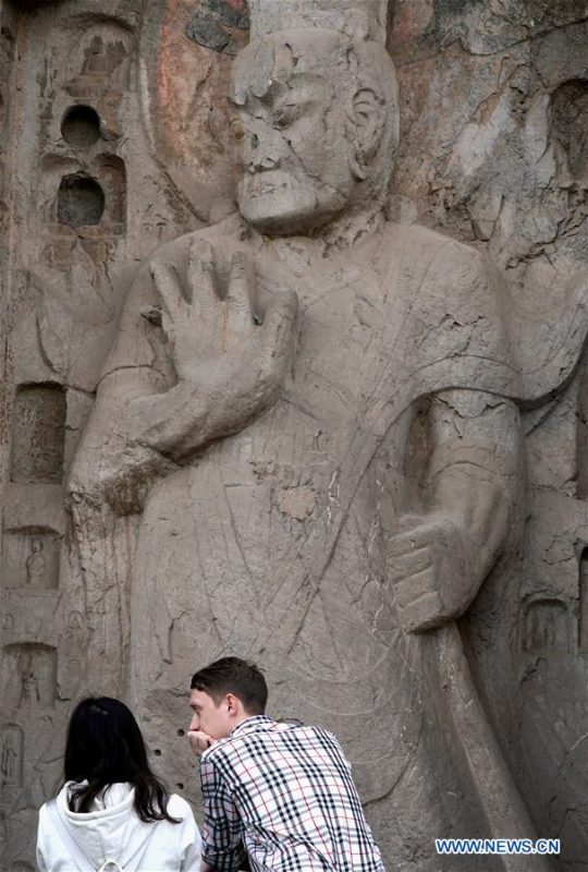
The historic identity of Luoyang is associated with multiple periods of Chinese history, old urban quarters, archaeological sites, temple complexes, river corridors, and former capital landscapes. Some of these places are concentrated in or near central districts such as Laocheng, Xigong, Chanhe Hui, and Luolong. Other heritage locations can sit outside the area a first-time visitor would consider “downtown.”
- For heritage research: identify the exact site and its present district or county. “Luoyang” alone is too broad for fieldwork planning.
- For a first visit: choose accommodation based on the attractions and transport nodes you will actually use, not merely on the municipal name.
- For historic mapping: distinguish the boundaries of a past capital or archaeological zone from current district boundaries.
- For official data: verify whether a source refers to the entire prefecture-level municipality, a district, or a smaller urban area.
This distinction is especially important for anyone comparing historical maps with current digital maps. Historical Luoyang may describe a capital-city landscape from a particular dynasty, while modern luoyang city describes a much larger administrative jurisdiction.
Match your research question to the correct geographic unit
Researchers and visitors should select the geographic unit before collecting transport details, demographic references, accommodation options, or site lists. The following procedure prevents most location errors.
- Define the object of interest. Decide whether you are studying municipal administration, a historic site, a downtown neighborhood, a rural county, or a single attraction.
- Record the complete current location. Capture the site name, district or county, and the nearest practical transport point. Avoid recording only “Luoyang.”
- Check the date of your source. Administrative terminology can differ between older and newer references, particularly for places whose status has changed.
- Compare map labels carefully. A map pin may show a district name, a town name, or a scenic-area brand rather than the municipality name.
- Estimate travel by origin and destination. Plan from your actual hotel, station, or airport location to the precise district or county, not from a generic city-center marker.
- Use the governing unit that matches your purpose. Municipal sources suit citywide policy questions; district and county sources are more useful for local addresses and services.
Recommendation: create a small location record for every place in your itinerary or research dataset. Include the current administrative division, the type of place, and the map source used. This method is appropriate for multi-site visits and comparative research. It may be unnecessary for a single, centrally located museum visit with a confirmed address.
Common mistakes when interpreting Luoyang on maps and in travel sources
Most confusion around luoyang city comes from using a correct name at the wrong scale. These mistakes are easy to avoid once the administrative hierarchy is clear.
- Mistake: treating the municipality as a compact downtown area.
Why it fails: the municipality includes districts and counties with different settlement patterns and travel conditions.
Better approach: check whether the destination is in a central district, an outer district, or a county before setting an itinerary. - Mistake: assuming “old city” means the entire historic capital.
Why it fails: historic sites and cultural landscapes are distributed across more than one present-day district.
Better approach: use the formal site name and current administrative location. - Mistake: relying on an older administrative label without checking it.
Why it fails: older materials may classify an area differently from current official references.
Better approach: compare the source date with a current administrative map or government listing. - Mistake: using city-level population or economic data to describe a specific district.
Why it fails: municipality-wide data can include rural counties and areas far from the urban core.
Better approach: label every statistic with its geographic scope. - Mistake: booking accommodation based only on the word “Luoyang.”
Why it fails: the listing may be in an outer district or near a destination unrelated to your planned sites.
Better approach: verify the district, nearby transit connection, and distance to your first scheduled location.
These checks matter even for casual travel. A search result can be technically located in luoyang city while being impractical for a traveler focused on the historic center. For academic work, the same mistake can affect the validity of a map, dataset, or regional comparison.
Choose the right planning approach for your purpose
Different users need different levels of administrative precision. The table below provides a practical decision guide.
| Your purpose | Best geographic unit to start with | Key check before acting | Limit of this approach |
|---|---|---|---|
| First-time cultural visit | Central district plus exact attraction address | Confirm the attraction’s district and transport access. | Does not cover scenic areas or county destinations outside the core. |
| Historic-capital research | Specific archaeological or heritage site | Separate historical boundaries from current administrative boundaries. | Site-level research may require more than municipal maps. |
| Municipal policy or regional data research | Prefecture-level municipality | Confirm whether data includes all districts and counties. | Citywide figures may hide differences within the urban area. |
| County tourism or rural fieldwork | Named county and county seat or destination town | Check the route from the central city independently. | Municipal branding alone is not enough for detailed transport planning. |
| Address verification | District or county, then street or town | Use the complete administrative chain. | A municipality name alone cannot confirm a precise location. |
The clearest rule is simple: use luoyang city for the broad modern municipality, but narrow the reference whenever a decision depends on location. This is the right approach for destination research, mapping, historical interpretation, and address checking. It does not replace direct confirmation from a venue, local authority, or current mapping service when travel arrangements are time-sensitive.
For a research itinerary or destination brief, request a current administrative map and verify each site by district or county before finalizing plans.