
Blog
How Luoyang’s Capitals Shaped Its Modern City Layout

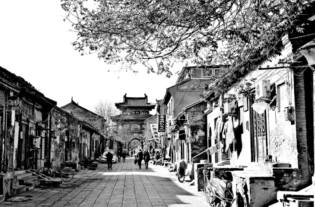
How Luoyang’s Successive Capital Eras Shaped Its Modern City Layout
Anyone studying a map of Luoyang for the first time runs into the same puzzle: why does one city contain three or four separate “old towns,” each with its own walls, gates, and ruin sites, scattered miles apart rather than stacked on top of each other? The answer lies in geography as much as politics. Luoyang was rebuilt in a new location almost every time a new dynasty claimed it as capital, and each rebuild followed the rivers and hills available at that moment in history. Understanding that pattern is the fastest way to make sense of the modern city’s layout — and to avoid wasting a research trip looking for the wrong ruins in the wrong district.
Why Luoyang Kept Being Chosen as a Capital
Luoyang sits in a natural basin framed by mountains to the north and south, with the Yellow River system feeding two smaller tributaries — the Luo River and the Yi River — directly through the plain. That combination mattered for three practical reasons that recur across Chinese dynastic planning:
- Water transport — grain barges and building materials could move along the Luo River into the Grand Canal network, which later linked the city to the Silk Road trade routes reaching west.
- Natural defense — mountain ranges on two sides reduced the length of wall needed and slowed approaching armies.
- Central position — Luoyang sat closer to the geographic middle of the early Chinese heartland than Chang’an, making it easier to administer eastern territories.
These same three factors explain why the city was rebuilt in slightly different spots rather than simply expanded outward from one core.
How River Corridors and Defensive Geography Shaped Luoyang’s Historic Districts
This is the part most visitors and researchers get wrong before they ever arrive: Luoyang is not one continuous historic core. It is a sequence of capital sites laid down along the river corridor over roughly a thousand years, each one chosen for a different defensive or logistical reason. Getting this sequence backward is the single most common mistake in early-stage research, because it leads people to expect Tang dynasty architecture inside a Han dynasty ruin field, or vice versa.
| Capital Era | Location Relative to the Rivers | Defensive / Logistical Logic | What It Affects Today |
|---|---|---|---|
| Eastern Zhou period | South bank of the Luo River, on flat plain | Open ground required a full enclosing wall; no natural barrier used | Foundational layers under the modern Old City district |
| Eastern Han, Cao Wei, Western Jin, Northern Wei | Northeast of the later Sui-Tang site, closer to the Mang Mountains | Hills to the north gave a natural defensive edge, reducing wall length | The separate Han-Wei Luoyang City ruins park, several kilometers from the modern downtown |
| Sui and Tang dynasties | Between the Luo River and the Yi River, on a wider stretch of plain | Two rivers acting almost like a natural double moat, plus room for a large planned grid | The modern downtown grid, including sites like Dingding Gate and the reconstructed Ming Hall |
The practical consequence: if your itinerary or research notes assume all “ancient Luoyang” sites sit inside one perimeter, you will misjudge travel distances and mix up which ruins belong to which dynasty. The Han-Wei site and the Sui-Tang site are not overlapping neighborhoods — they are separated capital footprints built centuries apart, connected mainly by the same river corridor rather than shared streets.
Reading the Modern Map Correctly: A Step-by-Step Approach
For researchers or travelers trying to connect the dynastic timeline to the current street grid, a simple sequence avoids most confusion:
- Start with the river lines first, not the district names. Locate the Luo River and Yi River on a current map before layering in any historic site.
- Identify which capital era you are researching, then match it to its river-relative position using the table above rather than assuming proximity to the modern city center.
- Check whether the site is a preserved ruins park (Han-Wei) or a rebuilt/reconstructed landmark within the living city (much of the Sui-Tang core).
- Cross-reference distance — the Han-Wei ruins area sits a noticeable drive from the modern downtown, while Sui-Tang era landmarks are largely walkable within the present city.
- Only after those four steps, plan movement between sites — trying to walk between eras on foot is a frequent planning error.
Common Mistakes When Connecting Luoyang’s Past to Its Present Layout
- Assuming one continuous “old town.” In reality, the capital moved location multiple times across dynasties, so historic layers are geographically distinct, not stacked.
- Confusing the Luo River with the Yi River when reading older gazetteers or translated maps — the two waterways framed different capital-era boundaries.
- Underestimating travel time to the Han-Wei ruins because it feels close on a small-scale map but sits well outside the modern urban core.
- Expecting Tang-era grid streets everywhere — the fine-grained planned grid belongs mainly to the Sui-Tang footprint, not earlier eras.
- Treating “Luoyang” as a single fixed point rather than a corridor of capital sites shaped by defensible terrain and river access over time.
What This Means for Early-Stage Research or Trip Planning
If your goal is academic research into pre-Tang urban planning, the Han-Wei ruins area, oriented toward the Mang Mountains, is the more relevant reference point — its layout reflects defensive priorities rather than commercial grid design. If instead you are tracing Silk Road-era trade infrastructure or Tang dynasty urban form, the space between the Luo and Yi rivers is the correct anchor, since that is where the planned capital grid and canal links were built. Mixing these two research goals without separating the geography first is the fastest way to produce inaccurate conclusions or a poorly sequenced site visit.
This distinction also matters for anyone documenting the city for academic or export-industry publications: describing “Luoyang’s ancient capital” without specifying which era’s footprint you mean can misrepresent both the location and the defensive logic behind it. The basin’s geography, not administrative convenience, is what actually dictated where each capital era stood.
A Practical Checklist Before Visiting or Citing Luoyang’s Historic Sites
- Confirm which dynasty’s capital footprint you are referencing before quoting distances or layouts.
- Verify the site’s position relative to the Luo River or Yi River, not just its name on a modern map.
- Separate reconstructed/rebuilt landmarks from original archaeological ruins in any citation.
- Budget extra travel time for sites outside the modern downtown core, particularly the Han-Wei ruins park.
- Cross-check any secondary source describing “Luoyang” as one fixed capital location — this is the most frequent factual slip in casual writing about the city.
For teams preparing research briefs, itineraries, or export-facing content that references Luoyang’s historic districts, it helps to have the river-corridor sequence confirmed before publication. If you are compiling a site guide, academic summary, or destination brief and want the dynastic-geography details checked for accuracy, send over your draft or site list and we can review the sequencing against the capital-era timeline.
About LyWOW Tours
LyWOW is a locally based travel agency in Luoyang, specializing in private tours for international travelers across Luoyang, Shaolin, Xi’an and Central China. English-speaking guides, flexible itineraries and door-to-door service.
Learn more about us or browse all our tours.
