By
By How Did Luoyang Become a Capital of Nine Dynasties?
The question is not merely “which dynasties ruled from Luoyang.” The more useful question is why so many regimes kept returning to the same stretch of the Yellow River basin. The answer involves grain transport, defensible terrain, and a political logic that repeated itself for over a millennium. Understanding that logic changes how you read the city’s surviving sites.
Luoyang sits in the western part of the North China Plain, where the Luo River flows into the Yellow River. That confluence is not scenic coincidence. It is the physical key to the city’s repeated selection as a capital. The surrounding basin is ringed by mountains on three sides — the Mangshan hills to the north, the Song mountains to the east, and the Qinling remnants to the west. Only the eastern side opens toward the plain. This created a natural fortress with a controlled entry point, a pattern repeated in many long-lived administrative centers.
But geography alone does not make a capital. A capital needs food. And food, in ancient China, meant grain shipped from the fertile eastern plains. Here the logic sharpens: Luoyang was the closest secure point to the eastern agricultural surplus that could still be defended from the west. Move the capital further east, and you lose the mountain shield. Move it further west, and the cost of transporting grain up the Yellow River becomes punishing.
That trade-off — between defense and supply — is the recurring theme of Luoyang’s nine dynastic periods. Each regime that chose Luoyang was making a specific calculation about where its threats came from and how it could feed its court and army.
A Dynasty-by-Dynasty Timeline: Geography and Political Logic
The “nine dynasties” list is not a single agreed-upon canon. Different historical sources count differently, sometimes including regimes that used Luoyang only as a secondary capital or for a brief period. The most commonly cited sequence includes the Eastern Zhou, Eastern Han, Cao Wei, Western Jin, Northern Wei, Sui, Tang (as eastern capital), Later Liang, and Later Tang. Each entry in this timeline links a capital decision to a specific geographic or political pressure.
| Dynasty / Period | Capital Status | Geographic Advantage | Political Pressure |
|---|---|---|---|
| Eastern Zhou (770–256 BCE) | Primary capital | Escape from western invasions; basin defense | Zhou royal house fled east after the Quanrong sack of Haojing |
| Eastern Han (25–220 CE) | Primary capital | Central position on the Yellow River; access to eastern grain | Rebuilding after Wang Mang’s collapse; needed a base away from destroyed Chang’an |
| Cao Wei (220–266 CE) | Primary capital | Existing Han infrastructure; control of central plains | Contest with Shu Han in the west and Eastern Wu in the south |
| Western Jin (266–316 CE) | Primary capital | Inherited Wei palace and layout | Brief unification; capital chosen for continuity, not new construction |
| Northern Wei (494–534 CE) | Primary capital (moved from Pingcheng) | Southern position to control the Yellow River valley; better climate for agriculture | Sinification policy under Emperor Xiaowen; needed a capital closer to the Chinese cultural core |
| Sui (581–618 CE) | Eastern capital | Hub for the newly built Grand Canal system | Emperor Yang needed a logistics node to move grain from the south to the northern frontier |
| Tang (618–907 CE) | Eastern capital (secondary to Chang’an) | Relief from Chang’an’s periodic food shortages; canal terminus | Court moved east during famines and to project power into the eastern plains |
| Later Liang (907–923 CE) | Primary capital | Distance from the shattered Chang’an region | Post-Tang fragmentation; warlord Zhu Wen needed a defensible base in the central plains |
| Later Tang (923–936 CE) | Primary capital | Same basin logic; existing urban fabric | Short-lived regime claiming Tang legitimacy; Luoyang symbolized that continuity |
What the table shows is a pattern, not a coincidence. Luoyang was rarely chosen because it was the largest or richest city. It was chosen because it was the least bad compromise between competing demands. When the empire was unified and the frontier was in the northwest, Chang’an made more sense. When the empire was fragmented, or the frontier shifted east, or the grain supply became critical, Luoyang reasserted itself.
This is why the “nine dynasties” label can mislead. It suggests a continuous, glorious capital status. In reality, Luoyang’s history as a capital is punctuated — periods of intense construction followed by abandonment, destruction, and rebuilding. The city was burned, sacked, and rebuilt multiple times. Each rebuilding reused the same geographic logic but on different physical ground, sometimes slightly shifted from the previous site. Modern archaeological work has identified several distinct city layers, each corresponding to a different dynastic rebuilding.
What the Geography Actually Affects in Practice
For a traveler or researcher, the geographic argument is not abstract. It explains where things are and why they survive where they do. Get this wrong, and you will misread the landscape.
Grain transport and the canal system. The Sui and Tang use of Luoyang was inseparable from the Grand Canal. The Tongji Canal, completed under Emperor Yang, connected the Yellow River at Luoyang to the Huai River system and, ultimately, to the Yangtze. Grain from the south could be shipped to Luoyang and then transferred to smaller vessels for the difficult journey west to Chang’an. When the canal silted or was neglected, Luoyang’s importance dropped. The city’s fate was tied to water engineering as much as to politics.
Defensive terrain and the passes. The “three mountains” are not just scenery. The Hangu Pass to the west and the Huanyuan Pass to the southeast were the two critical gateways. Control those passes, and you controlled access to the basin. Lose them, and the basin became a trap. Several of Luoyang’s most famous military episodes — the battles around Hangu Pass during the Warring States period, the sieges during the An Lushan rebellion — turn on this geography. When you stand at the old city site, the mountains are not a backdrop; they are the reason the city is there.
Flood risk and the Yellow River. The same river that brought trade and water also brought destruction. The Yellow River has shifted course dramatically over centuries, and Luoyang’s location near its confluence with the Luo River meant periodic catastrophic flooding. This is why successive dynasties rebuilt on slightly different sites — not because they wanted a new view, but because the old site was buried under silt or had become indefensible. The modern city sits on a different footprint from the Eastern Han capital.
Common Mistakes in Reading Luoyang’s History
Several misconceptions recur in travel writing and even in some academic summaries. Avoiding them sharpens your understanding of the city.
- Mistake: “Luoyang was the capital of nine consecutive dynasties.” The dynasties were not consecutive. There were gaps of centuries between some periods. The Eastern Zhou capital ended in 256 BCE; the Eastern Han capital began in 25 CE — a gap of nearly 280 years. Treating the nine as a continuous sequence distorts the timeline.
- Mistake: “The capital was always in the same place.” The city moved. The Zhou royal city, the Han-Wei city, and the Sui-Tang city are distinct archaeological sites, sometimes kilometers apart. The famous Longmen Grottoes are associated with the Northern Wei and Tang periods, but the exact relationship between the grottoes and the contemporary city changed as the city shifted.
- Mistake: “Luoyang was always the primary capital.” Under the Tang, Luoyang was explicitly a secondary capital. The court spent part of the year there, particularly during food shortages in Chang’an, but the primary seat remained in the west. The “eastern capital” status was real but not equivalent to being the sole seat of power.
- Mistake: “The geography made Luoyang an obvious choice.” The geography was a constraint, not a destiny. Several rival sites in the same region — Kaifeng, Zhengzhou, Xuchang — had some of the same advantages. Luoyang’s repeated selection owed as much to existing infrastructure, political symbolism, and historical inertia as to pure geographic determinism.
A Buyer’s Decision Checklist for Historical Travelers
If you are planning research or a visit focused on Luoyang’s dynastic history, the following checklist helps you filter what to see and how to interpret it.
- Identify the dynasty first. Before visiting a site, confirm which dynastic layer it belongs to. The White Horse Temple, for example, is traditionally dated to the Eastern Han but has been rebuilt many times. The visible structures are not Han. Knowing the layer prevents category errors.
- Check the water infrastructure. Look for canal traces, river channels, and flood deposits. These are not minor details; they explain why the city was viable at a given time. The Hanjia Granary site, associated with the Sui-Tang period, is a direct physical link to the grain-supply logic.
- Map the passes. Hangu Pass and Huanyuan Pass are not just names in texts. Visiting them — even in their reconstructed or ruined state — anchors the defensive argument. You cannot understand why Luoyang was chosen without seeing what the passes controlled.
- Expect discontinuities. Do not look for a single continuous “old city.” Expect multiple sites, separated by distance and time. The Luoyang Museum and the Luoyang Ancient Tombs Museum both help clarify these layers, but they require you to hold the timeline in your head.
- Read the canal history. The Sui-Tang Grand Canal is a UNESCO World Heritage component. Its route through the Luoyang area is not always visible, but understanding its path explains the city’s Tang-era revival.
Worked Example: The Northern Wei Move in 494 CE
A specific case makes the pattern concrete. In 494 CE, Emperor Xiaowen of the Northern Wei moved the capital from Pingcheng (modern Datong) to Luoyang. The move was deeply controversial. The Tuoba elite had built Pingcheng as a steppe-adjacent power center, close to their cavalry base and far from the Chinese agricultural core. Moving south meant abandoning that base.
Why did Xiaowen do it? The standard explanation is sinification — the deliberate adoption of Chinese language, dress, and administrative norms. That is true, but it is incomplete. The geographic logic mattered equally. Pingcheng was cold, dry, and far from the grain surplus. Feeding the court and army there required constant transport from the south, a costly and unreliable proposition. Luoyang, by contrast, sat at the edge of the fertile plain, with the Luo and Yellow rivers providing water and transport. The move was a bet that the Northern Wei could become a Chinese-style dynasty ruling from a Chinese-style capital, rather than a steppe confederation ruling from the frontier.
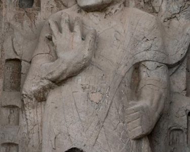
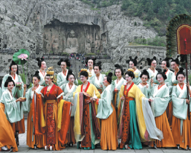
The bet paid off in the short term. Luoyang flourished under the Northern Wei, and the Longmen Grottoes, begun under Xiaowen’s patronage, became one of the great Buddhist sculpture projects in Chinese history. But the move also alienated the northern garrisons, who saw their status decline. The rebellions that eventually split the Northern Wei into Eastern and Western halves had roots in that alienation. Luoyang’s geographic advantages — its southern, agricultural, Chinese orientation — were precisely what made it unacceptable to the northern military elite.
This is the lesson of the case: a capital choice is not just about where the emperor sits. It is about which constituencies the regime chooses to favor. Luoyang favored the agricultural south and the Chinese administrative class. Pingcheng favored the steppe and the military. The Northern Wei’s move to Luoyang was a choice of one future over another, and the regime paid for that choice within a generation.
How to Read the Surviving Evidence
The physical remains of Luoyang’s dynastic history are unevenly preserved. The Han-Wei city site is largely agricultural land today, with low walls and scattered mounds. The Sui-Tang city is partly buried under the modern urban area. The Longmen Grottoes survive because they were carved into limestone cliffs, not built of perishable materials. The White Horse Temple survives as an institution, but its buildings are late reconstructions.
This unevenness is itself a historical document. Stone survives; wood and earth do not. Buddhist cave temples survive because they were carved into rock faces away from the floodplain. Palace foundations survive only as archaeological layers. If you want to understand Luoyang as a capital, you must read the landscape as much as the standing buildings. The mountains, the river confluences, the canal traces, and the pass locations are the most durable evidence of why the city was chosen, abandoned, and chosen again.
For researchers and serious travelers, the city’s dynastic history is best approached as a series of geographic decisions repeated over time. Each dynasty asked the same question: where can we defend ourselves, feed ourselves, and project power? And each time, for a specific set of reasons, the answer was the same basin where the Luo River meets the Yellow River.
If you are planning a research trip or need help structuring an itinerary around the dynastic layers of Luoyang, we can connect you with local historians and site-specific materials. Send us your research focus or travel dates, and we will suggest a route that respects the timeline rather than flattening it into a single “ancient capital” narrative.