 By
By How to Geographically Pinpoint Luoyang Henan China
For any business professional planning travel, logistics, or research in China’s Central Plains, simply finding a city on a digital map is not enough. Understanding *why* a city is located where it is provides critical context for its economic and historical significance. The precise location of Luoyang Henan China can be confusing, especially in relation to the modern provincial capital, Zhengzhou. The key to orienting yourself is not by memorizing coordinates, but by understanding the landscape that has defined the city for millennia: its two rivers, the surrounding plains, and the protective mountain ranges.
This approach moves beyond a simple pin on a map, offering a durable mental model for grasping the city’s strategic position. Luoyang’s location is a direct result of its geography, which has shaped everything from its role as an ancient imperial capital to its modern industrial and logistical corridors. By learning to read these natural landmarks, you can better understand the flow of transport, the distribution of resources, and the fundamental logic of the region’s layout.
The Strategic Importance of Luoyang’s Geographic Position
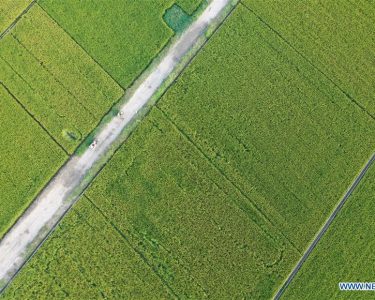
Luoyang’s long history as a capital for numerous Chinese dynasties was no accident. Its location offered a rare combination of agricultural abundance, natural defense, and central control over key transportation routes. Situated in western Henan province, the city lies in the heart of the Central Plains (Zhongyuan), an area often referred to as the cradle of Chinese civilization. This places it at a historical crossroads, connecting the ancient capital of Xi’an to the west with the commercial centers of the eastern coast.
The geography provided a perfect blueprint for a major hub. The fertile plains fed a large population, the rivers provided water and transport, and the mountains created a defensible fortress. This combination made the location of Luoyang Henan China a coveted prize for centuries. Even today, these ancient geographical advantages translate into modern logistical realities. The primary east-west railways and expressways follow the same natural corridor carved out by the Yellow River valley, reinforcing the city’s role as a vital link in China’s infrastructure network. Understanding this foundation is the first step in appreciating the city’s layout and its relationship with neighboring economic zones.

Using Natural Landmarks to Define Luoyang’s Location
To pinpoint Luoyang’s exact location without ambiguity, it is essential to look at the four key geographical features that define its position. Each element provides a specific clue, and together they form a complete picture that is far more intuitive than latitude and longitude alone. These features explain not just where Luoyang is, but why its development took the course it did.
The following table breaks down these landmarks and explains their practical significance for identifying the city.
| Geographical Feature | Location Relative to Luoyang | Practical Significance for Identification |
|---|---|---|
| Yellow River (Huang He) | Forms the northern boundary of the region. | This massive river is the most prominent landmark. Luoyang is situated a short distance south of its main channel. It creates a clear east-west corridor that has historically been the primary artery for travel and trade across northern China. |
| Luo River (Luo He) | Flows directly through the city’s southern area before joining the Yellow River further east. | This is the most critical landmark for precise placement. The city’s name, Luoyang, means “north of the Luo.” By finding where this smaller river runs, you find the city’s heartland. It provided a manageable water source and a fertile valley. |
| Yi-Luo River Plain | The flat, fertile basin in which the city is built. | This plain explains the city’s agricultural wealth. On a topographical map, Luoyang sits in a noticeable expanse of low-lying, flat land, which stands in contrast to the rugged terrain surrounding it. This plain is the reason a major settlement could thrive here. |
| Surrounding Mountains | Mangshan to the north, Songshan to the east, Funiu to the south and west. | These ranges form a natural, U-shaped defensive basin around the city. They act as walls, defining the edges of the plain and creating clear entry and exit points. Identifying these mountains confirms you have found the protected enclave where Luoyang is nestled. |
Common Misconceptions in Locating Luoyang for Business
For first-time visitors or researchers, several common errors can lead to confusion when analyzing the region. These misunderstandings often stem from over-reliance on simplified digital maps that strip away crucial topographical and administrative context. Avoiding these pitfalls ensures more accurate planning for logistics, site visits, and market analysis.
Here are the most frequent mistakes and how to correct them:
-
Mistake 1: Confusing Luoyang with Zhengzhou.
Zhengzhou is the large, modern capital of Henan and a primary national transportation hub. It often dominates search results and logistics discussions. However, Luoyang is a distinct city located approximately 120 kilometers to the west. While both are in the Yellow River economic corridor, they serve different functions. For matters related to heavy industry, ancient history, or specific cultural tourism, Luoyang Henan China is the correct focus. For provincial administration and high-speed rail connections, Zhengzhou is the central point.
-
Mistake 2: Underestimating the Scale of the Rivers.
On a map, the Yellow and Luo rivers appear as simple blue lines. In reality, the Yellow River is one of the world’s largest and most dynamic river systems. Its floodplain is vast, and its course has shifted over centuries. Any business related to agriculture, water management, or large-scale construction must consider the entire river basin, not just the current channel. The Luo River, while smaller, also defines a significant valley that influences local transport infrastructure.
-
Mistake 3: Ignoring the Topographical Barriers.
A flat political map of China can be misleading, making Henan appear entirely open. The mountain ranges surrounding Luoyang are substantial geographical barriers. The Funiu Mountains to the south, for example, separate the Central Plains from the Nanyang Basin. This impacts ground transportation, creating natural choke points. Logistics planning must account for these mountain passes, which can affect travel times and route availability, especially for heavy freight.
A Practical Checklist for Verifying Your Destination
To synthesize this information into an actionable process, use the following checklist to confirm you are analyzing the correct location and its context. This step-by-step verification ensures you have a comprehensive geographical understanding before making any travel or business commitments.
- Confirm the Provincial Context: Start by isolating Henan Province on a map of China. Ensure you are not looking at a similarly named town or district in another province.
- Locate the Two-River System: Trace the Yellow River (Huang He) westward from Zhengzhou. Then, identify the smaller Luo River (Luo He) running parallel to its south. Luoyang is situated squarely on the plains between these two waterways.
- Identify the Mountain Basin: Look for the topographical features that enclose the city. Pinpoint the Funiu Mountains to the south and west and the Songshan Mountains to the east. This confirms you have located the naturally protected basin where the city lies.
- Trace Modern Infrastructure Arteries: Note the major east-west transport routes, such as the G30 Expressway and the Longhai Railway. You will see that they follow the natural corridor created by the river valleys, passing directly through Luoyang. This confirms the city’s modern logistical importance.
- Establish Regional Orientation: Clearly mark the relative positions of the three major historical capitals in the region: Luoyang, Zhengzhou (to the east), and Xi’an (to the west). This places Luoyang in its proper context within one of China’s most significant economic and cultural corridors.
By following these steps, you build a mental map that is resilient and practical. You will not only know where Luoyang is, but you will also understand the geographical logic that has guided its existence for thousands of years.
For more detailed logistical planning or market analysis within the western Henan region, contact our team for expert guidance.