By
By Understanding the Strategic Rise of Luoyang City Henan
Why did thirteen ancient dynasties establish their capital in one specific location? The enduring prominence of Luoyang city Henan was not an accident of history; it was a deliberate choice dictated by geography. For ancient rulers, selecting a capital was the single most important strategic decision, balancing defense, agriculture, and control over a sprawling empire. Luoyang’s unique position at the confluence of major rivers and surrounded by natural mountain barriers made it the ideal command center for much of ancient Chinese history.
Understanding this location is to understand the fundamental principles of pre-industrial statecraft, where terrain was destiny. The city’s layout and its historical significance are direct results of the landscape that cradles it. For any organization looking at the logistical or historical context of Central China, grasping Luoyang’s geographical advantages is the essential first step. This region served as the heart of Chinese civilization for centuries, largely because of the formidable and favorable features of its environment.
The Geographic Fortress: How Rivers and Mountains Forged Luoyang’s Destiny
The selection of Luoyang was a masterclass in using natural terrain to create a secure and prosperous administrative hub. The city is not merely located on a plain; it sits within a protected basin, a natural fortress created by a precise combination of mountains and rivers. Each geographical feature played a distinct and critical role in its viability as a capital. Misinterpreting the function of even one of these elements would mean failing to grasp why this specific location was so coveted by emperors.
Here is a breakdown of the key geographic components and their strategic impact on Luoyang city Henan:
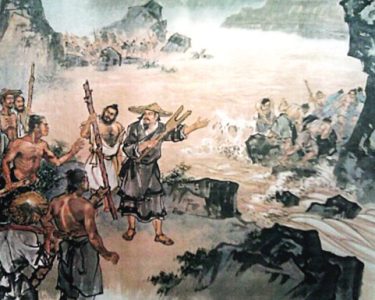
- The Yellow River (Huang He) – The Northern Shield: Situated to the north of Luoyang, the mighty Yellow River served as a massive natural moat. Its wide, often turbulent waters made large-scale military crossings extremely difficult for invading armies from the northern steppes. This provided a formidable first line of defense, allowing rulers to focus military resources elsewhere. However, it was also a source of risk; the river’s propensity for catastrophic flooding meant that while it offered protection, it also demanded constant management and respect.
- The Luo River (Luo He) – The Lifeblood Artery: Flowing directly through the region where the city was founded, the Luo River was the city’s stable lifeline. Unlike the volatile Yellow River, the Luo was more navigable and predictable. It provided a reliable source of water for the capital’s massive population and for agriculture. Crucially, it functioned as a key transportation channel, connecting Luoyang to other regions and allowing for the efficient movement of grain, goods, and troops. The city’s very name, Luoyang, means “north of the Luo River,” signifying its intimate connection.
- The Surrounding Mountains – The Defensive Walls: Luoyang is encircled by mountains that create a highly defensible basin.
- To the north lie the Mang Mountains, providing a secondary barrier behind the Yellow River.
- To the south are the Funiu Mountains, guarding against incursions from that direction.
- To the east is the sacred Song Mountain, which not only offered defense but also held deep cultural and religious significance.
- To the west, the Qinling Mountains create a formidable barrier.
This ring of high ground created narrow, controllable passes, forcing any attacking army into predictable choke points where they could be easily confronted.
- The Central Plains (Zhongyuan) – The Imperial Breadbasket: The land within this protected basin is part of the incredibly fertile Central Plains. The alluvial soil, deposited by the rivers over millennia, was perfect for agriculture. This allowed the region to support a large, non-farming population of administrators, soldiers, and artisans necessary to run an empire. A capital that could not feed itself was doomed to fail, and Luoyang’s access to this rich hinterland ensured its long-term sustainability.
Avoiding Strategic Miscalculation: A Checklist for Assessing Ancient Capital Sites
The principles that made Luoyang an ideal capital can be distilled into a universal checklist for evaluating the viability of any pre-industrial strategic center. For historians, logisticians, or regional analysts, using this framework helps deconstruct why certain cities thrived while others faded. Applying this to Luoyang city Henan reveals a near-perfect score.
Failing to meet even one of these criteria often led to the decline or relocation of a capital. Use this checklist to understand the complex interplay of factors required for a successful imperial seat.
| Strategic Requirement | Evaluation Question | Luoyang’s Example |
|---|---|---|
| Defensible Terrain | Does the landscape offer natural barriers (rivers, mountains, deserts) that impede invasion and create strategic choke points? | Excellent. Encircled by the Mang, Song, and Funiu mountains with the Yellow River as a northern moat. |
| Agricultural Sustainability | Is there a sufficiently large and fertile hinterland to produce a food surplus for a large, non-agricultural population? | Excellent. Located in the heart of the fertile Central Plains, a primary breadbasket of ancient China. |
| Water Security | Is there a reliable, year-round source of fresh water for consumption, sanitation, and industry? | Good. The Luo River provided a stable and accessible water source, though the larger Yellow River was prone to flooding. |
| Logistical Connectivity | Does the location facilitate the movement of goods, taxes (in the form of grain), and armies to and from all parts of the empire? | Excellent. The Luo River and ancient road networks connected Luoyang to key economic and military regions. Its central position was key. |
| Centrality of Control | Is the city located centrally within the empire’s core territories to project power and receive information efficiently? | Excellent. Known as the “Center Under Heaven,” Luoyang’s position on the Central Plains was ideal for governing the core Han territories. |

The “Center Under Heaven”: Why Centrality Mattered More Than Anything
Beyond the immediate security of mountains and rivers, Luoyang’s position in the heart of the Central Plains gave it an unparalleled strategic advantage in governing a unified China. Ancient communication and transportation were slow and arduous. A capital on the empire’s periphery would receive news of a rebellion or invasion dangerously late. Orders sent from a coastal or frontier capital would take weeks or months to reach the opposite end of the realm, making effective rule nearly impossible.
Luoyang’s central location minimized these communication delays. It functioned as the hub of a vast network of roads and waterways, allowing imperial decrees, tax revenues, and military legions to move with relative efficiency in all directions. This centrality is why the region was often referred to as Zhongyuan (the Central Plains) or even Tianxia Zhongxin (the Center Under Heaven). An emperor ruling from Luoyang could project power and maintain cohesion across disparate territories more effectively than from almost any other location.
This concept was both practical and ideological. Ruling from the geographic center reinforced the emperor’s legitimacy as the central axis around which the entire world revolved. Therefore, controlling Luoyang and the surrounding plains was synonymous with controlling China itself. Dynasties that held this region were seen as legitimate, while those that lost it were often seen as having lost the “Mandate of Heaven.” This deep cultural and political significance, built upon a foundation of hard geographic reality, cemented Luoyang’s status for over 1,500 years.
Understanding the deep-rooted geographical and historical context of key economic zones is crucial for modern enterprise. For businesses looking to engage with the markets and logistics of Central China, this foundational knowledge provides a significant advantage. Contact our technical team to discuss how regional analysis can inform your strategic planning.