By
By Why Lo Yang China Became a Nine-Dynasty Capital
Why did nine separate dynasties choose the same city as their seat of power? The answer for Lo Yang China is not cultural accident. It sits at a precise intersection of transport routes, defensive terrain, and agricultural supply. A ruler who controlled Luoyang controlled the flow of grain, troops, and tax revenue across the North China Plain. Lose it, and the empire split. That is the core logic repeated from the Eastern Zhou through the Later Tang.
Most early-stage history readers ask the same question: was Luoyang simply a traditional choice? No. Each dynasty made a calculated decision. The city offered a rare combination of central access and natural protection. The mountains to the west blocked invaders from the Gansu corridor. The Yellow River to the north slowed cavalry. The Yi and Luo rivers provided water for a dense urban population. When a dynasty needed to control the eastern plains but still guard the western passes, Luoyang was the only practical option.
Transport Routes: The Grain That Built Empires
The first and most decisive factor was logistics. Ancient Chinese capitals consumed enormous quantities of grain. A capital like Chang’an (modern Xi’an) sat deep in the Wei River valley. When harvests failed or canals silted up, the court starved. Luoyang solved this problem. It sat at the head of the Grand Canal network that connected the Yangtze River basin to the north.
What did this mean in practice? A barge loaded with rice from the lower Yangtze could reach Luoyang without portaging over mountain passes. The same barge would struggle to reach Chang’an. The Tong Pass, the main western gateway, was a narrow defile. Armies could hold it with a few hundred men. But grain barges could not climb it. Every sack of rice bound for Chang’an had to be unloaded and carried by cart or porter. That cost more than the rice itself.
Luoyang avoided this bottleneck. The Luo River flows north into the Yellow River. From there, canals ran east to the Huai and south to the Yangtze. A court in Luoyang could feed itself even when the surrounding countryside suffered drought. That reliability was worth more than any palace wall.
What happens if a buyer of historical analysis gets this wrong? They assume all ancient capitals were equal. They miss why the Sui and Tang courts repeatedly moved east to Luoyang during famines. Emperor Yang of Sui built the Grand Canal precisely to link his eastern capital at Luoyang with the southern rice surplus. The canal was not a vanity project. It was an artery.
Defensive Terrain: The Four Gates of the Empire
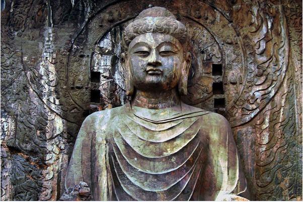
Luoyang is not an open city. It sits in a basin ringed by mountains on three sides. To the west, the Xiao Mountains and the Hangu Pass guard the road to Chang’an. To the east, the Hulao Pass controls access from the North China Plain. To the south, the Longmen gorge pinches the Yi River. To the north, the Yellow River and the Mangshan hills form a natural wall.
This geography gave defenders options. A dynasty could retreat into the western mountains if the eastern plain fell. It could sally east through Hulao Pass to crush a rebellion. It could hold the Longmen narrows against southern armies. No other city on the North China Plain offered this combination of access and control.
Compare this to Kaifeng, another eastern capital. Kaifeng sits on flat alluvial land. It has no mountains within a day’s march. Defenders relied entirely on walls and canals. When the walls broke, the city fell. Luoyang’s defenders always had a fallback position. That mattered to dynasties facing constant military pressure from steppe nomads and internal rebels.
The western passes deserve special attention. The Hangu Pass was one of the most fortified points in ancient China. An army holding Hangu could block an enemy force ten times its size. The pass sits between steep loess cliffs and the Yellow River. There is no room to maneuver. For a dynasty based in Luoyang, this was a shield against any rival based in Chang’an or the northwest.
Political Geography: The Center of the World
Chinese political thought divided the realm into regions. The North China Plain was the economic heartland. The Wei River valley was the western bastion. The Yangtze basin was the southern frontier. Luoyang sat at the hinge of all three. It was close enough to the eastern plain to collect taxes and conscript soldiers. It was close enough to the western passes to defend against invasions. It was connected to the south by river and canal.
This centrality shaped dynastic strategy. The Eastern Zhou moved the capital east from Haojing to Luoyang in 771 BCE after the western capital was sacked. The move was not a retreat. It was a repositioning. The Zhou kings needed to be closer to the loyal eastern states and the grain-producing plains. Luoyang allowed them to project power without overextending supply lines.
The Eastern Han made the same calculation. The Western Han had ruled from Chang’an. But by the first century CE, the economic center of gravity had shifted east. Powerful landowning families lived in the eastern plains. The court needed their cooperation. Luoyang put the emperor in their midst while still guarding the western approaches against the Qiang and Xiongnu.
Comparison: How Each Dynasty Used Luoyang’s Geography
The nine dynasties that made Luoyang their capital did not all use the city the same way. Their choices reveal different strategic priorities. The table below connects each major dynasty to the transport, defensive, and political logic that drove the decision.
| Dynasty | Transport Logic | Defensive Logic | Political Logic |
|---|---|---|---|
| Eastern Zhou (771–256 BCE) | Access to eastern grain via the Luo and Yellow rivers | Mountain ring vs. western invaders | Move closer to loyal eastern vassal states |
| Eastern Han (25–220 CE) | Grain from the North China Plain; less reliance on Wei valley | Hangu Pass shield against Qiang raids | Balance powerful eastern landowning clans |
| Cao Wei (220–265 CE) | Control of Yellow River shipping lanes | Forward base against Shu Han in the west | Legitimize rule from the old Han capital |
| Western Jin (265–316 CE) | Central grain distribution hub | Defensive depth against northern nomads | Unify the Three Kingdoms from the center |
| Northern Wei (493–534 CE) | Move south to access Han agricultural surplus | Escape steppe pressure in the far north | Sinification policy; adopt Han capital tradition |
| Sui (581–618 CE) | Grand Canal terminus linking Yangtze to north | Buffer between Chang’an and eastern rebels | Dual-capital system; east for food, west for defense |
| Tang (618–907 CE, intermittent) | Relief from Chang’an famine; canal access | Fallback when western passes threatened | Secondary capital for empresses and grain courts |
| Later Liang (907–923 CE) | Eastern grain and tax collection | Distance from Shatuo rivals in Shanxi | Break from Tang legacy; new eastern power base |
| Later Tang (923–936 CE) | Restore central control over canal revenue | Defend against Khitan incursions from north | Claim legitimacy as Tang successor |
Notice the pattern. Every dynasty that chose Luoyang faced pressure from one direction and opportunity from another. The city let them pivot. A court based in Chang’an could only look west. A court in Kaifeng could only look east. Luoyang let a ruler do both.
When does this logic fail? Luoyang’s geography is a double-edged sword. The same mountains that protect the city also constrain it. If an enemy seizes the Hangu Pass, Luoyang is cut off from the west. If the Hulao Pass falls, the eastern plain pours in. The city is a hinge — and hinges can break. The Western Jin lost Luoyang in 311 CE when the Xiongnu stormed through the northern defenses. The city never fully recovered its status as a capital after that. The lesson: centrality is an asset only if you can hold the passes.
Common Mistakes in Reading Luoyang’s History
Students and casual readers often misread the evidence. Here are the most frequent errors and how to correct them.
- Mistake: Luoyang was always the capital. Correction: It was one of several capitals. The Tang used Chang’an as the primary capital and moved to Luoyang during famines or military crises. The “nine dynasties” count includes short-lived regimes like the Later Liang and Later Tang.
- Mistake: The Grand Canal made Luoyang inevitable. Correction: The canal was built partly because Luoyang was already important. The Sui chose the route to serve the eastern capital, not the other way around.
- Mistake: Defensive terrain alone explains the choice. Correction: Terrain matters only with a competent army to hold it. The Western Jin had the same mountains as the Eastern Han. They lost the city in weeks because the court was weak and divided.
- Mistake: Luoyang’s decline was geographic. Correction: The decline was political and economic. As the economic center shifted further south to the Yangtze delta, Kaifeng and later Nanjing and Beijing became more practical capitals. Luoyang’s geography did not change; the empire’s shape did.
A Buyer’s Checklist for Evaluating Ancient Capitals
If you are researching why a city became a capital — whether Luoyang, Chang’an, Kaifeng, or Nanjing — use this checklist to test the argument.
- Grain supply: Can the city be fed from surplus regions without impossible transport costs? If not, any capital there is temporary.
- Defensive depth: Does the city have natural barriers on at least two sides? Flat cities require massive walls and standing armies.
- Political access: Is the city close enough to the major tax-paying and soldier-supplying regions? A remote capital loses control.
- Escape route: If the walls break, can the court retreat to a defensible position? Luoyang had the western mountains; Kaifeng did not.
- Water access: Is there a navigable river or canal? Ancient cities without water access could not grow beyond a few hundred thousand people.
- Pass control: Who holds the key passes? A capital is only as secure as its gateways.
Apply this checklist to any capital in world history. Rome, Constantinople, Paris, Kyoto — the same factors recur. Grain, terrain, politics, water. Luoyang scores high on all four, which is why nine dynasties returned to it despite repeated destruction.
What Lo Yang China Teaches About Strategic Choice
The repeated selection of Lo Yang China as a capital was not inertia. It was a rational response to a specific set of geographic and logistical constraints. The city offered the best available compromise between eastern grain, western defense, and central political control. When that compromise held, dynasties flourished. When it broke, they fell.
For a modern reader, the lesson is transferable. Whether choosing a warehouse location, a distribution hub, or a regional headquarters, the same questions apply. Where is the supply? Where is the threat? Where is the customer? Luoyang answered all three for nine dynasties. That is a track record no other Chinese city can match.
For further reading on ancient capitals and their strategic logic, consult the historical geography of Luoyang and the records of the Grand Canal’s construction. These primary and secondary sources provide the granular detail behind the patterns described here.
Need a deeper briefing on a specific dynasty’s use of Luoyang or a comparison of ancient capital logistics? Request a focused research note with transport maps and defensive terrain analysis.